
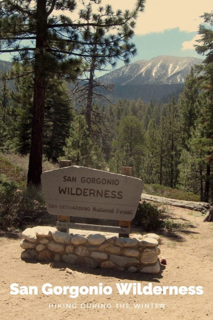
Hiking San Gorgonio in the Winter Months
He who has not descended Old Grey Back is like a savage who listens to the tuning up of an orchestra and goes off pleased- thinking he has heard the concert – Theodore S Van Dyke 1875
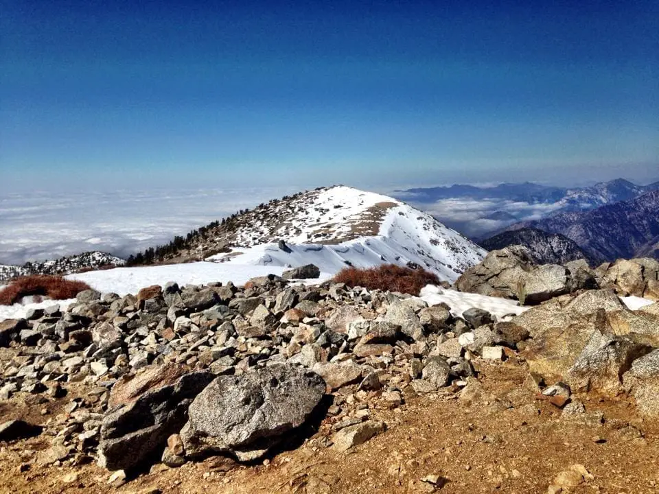
San Gorgonio Hike in Winter
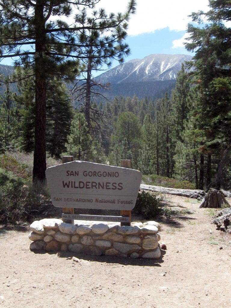
The first time I set foot to hike the San Gorgonio Wilderness I had no idea how obsessed I would become with these alpine trails. I simply set out for a walk in the woods on a chilly morning. It was ten years ago, and I was a trail runner and marathoner at the time. Back in the day, there were so many mornings I would run ten miles in the a.m. training for this or that half marathon, slowly adding up the miles. Once I discovered the beauty and serenity of the San Gorgonio Wilderness this soon became my favorite area to trail run, jogging up scenic Momyer Trail or South Fork Trail deep in the San Gorgonio Wilderness. As I fought my way up the steep trails beneath shrub oak trees, my feet were pounding out the miles of trail as I ran through a forest of primrose bushes and past spruce pine trees lining the single track trail. Then I would go to my job in retail and work until one in the morning and get up at dawn again to enjoy my mornings in this stunning southern California wilderness before spending my evenings beneath fluorescent lighting for eight hours in my fifty-hour work week.
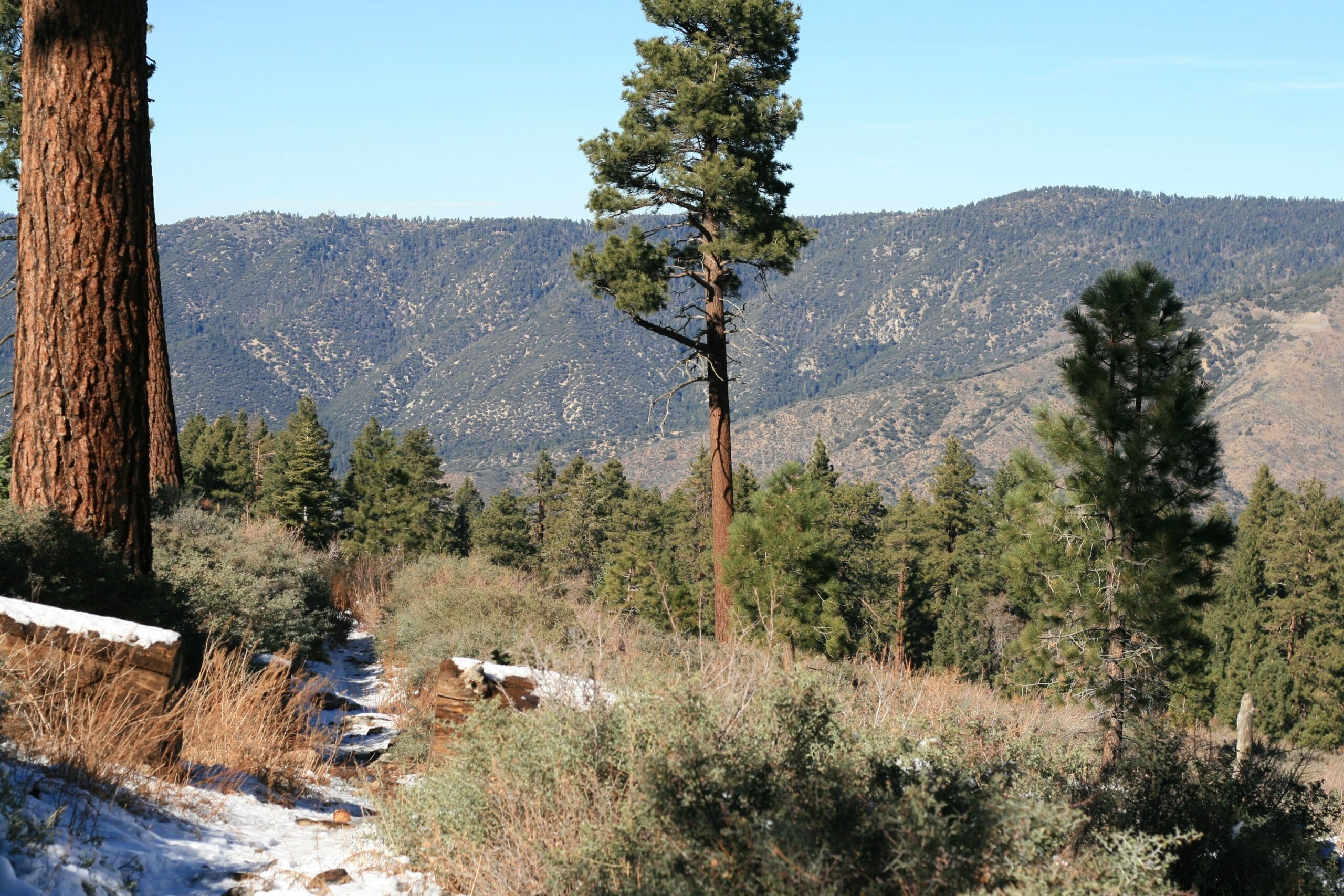
My mornings out in the beauty and serenity of the San Gorgonio Wilderness saved my sanity in these years. In the springtime, the wildflowers blooming near the sides of the trail were just gorgeous fields of rust-red Indian paintbrush and lavender lupines. The people who hike and run these forested trails know them mainly in the spring and summer months when the wildflowers are thick, and High Creek is flowing with crystal clear cold mountain water. Even the hardiest southern California hikers have no idea the pure beauty of the San Gorgonio Wilderness in the winter months. I’ve seen bobcats and bear tracks and even relaxed in snow caves other hikers built in the middle of Dry Lake at 9,000 feet deep in the deserted forest. I’ve picnicked in the snow with my little doggy in areas at 10,000 feet that look just like a photo of Switzerland. These areas are not easy to hike too, but the beauty you can hike to in the winter in southern California in the San Gorgonio Wilderness is awe-inspiring (And worth every mile and every blister and even freezing cold wet feet for miles)
Every winter I spend hundreds of hours on the trails of San G. I’ve summited San Gorgonio three times and I’ve hiked all the trails of the San Gorgonio Wilderness at least sixty times, usually hiking between eight and twenty miles in a single day hike. I usually have my little mutt dog at my side. It doesn’t matter to us if it’s the dead of winter in the San Gorgonio Wilderness; I bundle up and wear layers, and Carly Dog wears her favorite sweater, and we enjoy our snowy days on the highest peaks of the San Gorgonio Wilderness. I love days spent amongst the snowy peaks, and my little snow-loving doggy (Her nickname is The Mountain Goats) loves to explore the wilderness with me. My favorite time to explore the San Gorgonio Wilderness is the cold and chilly months between January and March. Any time there is snow on Jepson, Galena or San Bernardino Peak these are the best times to wander into the San Gorgonio Wilderness. Of course, you can’t wander into this wilderness as you need a permit to hike even a mile into the wilds and the local rangers are pretty stubborn on making sure every visitor into the wilderness from overnight backpackers to day hikers like myself always have a permit. Even the most experienced hikers can get lost out here if they get tired and take the wrong trail, or don’t have enough time to hike back down the mountain and get stuck on the mountain overnight.
That’s why, when hiking into the San Gorgonio Wilderness on those gorgeous February days there are a few important things you need to take into consideration. The hikes may seem easier when you are lower in altitude, and there is not a lot of snow but when you reach that altitude of over 8,000 feet the views of these jagged peaks are just phenomenal, and that’s because there could be a lot of snow on the icy trails. What that means is that it’s time to strap on your crampons and your hiking speed is going to slow way down. When the snow starts to get deeper, it will be time to put on your snowshoes and hiking in snowshoes is so much slower than regular hiking. All of these things need to be taken into consideration when doing a long hike or trying to summit San Gorgonio in the wintertime. If you are trying to summit the mountain in the winter, you want to start this hike at dawn to give you more then enough time in case the snowy trails take you hours longer then you planned for.
Winter Hiking Safety
Accidents happen on these trails. People slide down icy mountains. It happened to me, and it was terrifying (And yes, I still sumitted San Gorgonio that day) Most people do a hike like San G once in their lifetime. I’m really lucky that I live so close to this mountain and get to become an expert on it, exploring the snowy trails all winter long. Being comfortable with this mountain in my backyard I take more chances then I should. Like wearing shorts in the winter when ascending a mountain just because it’s a nice warm sixty-four-degree day in January. Take my advice; Don’t do that. This was the day I learned my lesson about hiking in the snow in shorts. As I was hiking about four miles up the Vivian Creek Trailhead, I slipped on an icy spot in the shade, and I landed on my right hand. As I slid down the mountain I thought for sure my hand was broken at first, (It turned out to be fine) but I had terrible snow rash all on my right leg (And I still summited the mountain four miles later like that) This story right here is why wearing long pants (Even on a warmer winters day) and using crampons is key to having a safe day on the icy trails of San Gorgonio. At the upper elevations, well anywhere more then a mile away from the car, really, there is no cell service if you get hurt badly. Yup, that means if you get hurt and you are alone you are hiking back out for help. (Like the one time I twisted my ankle five miles from the car and then almost stepped on a rattlesnake at 9,000 feet in December. Why on earth he wasn’t hibernating, I’ll never know) Take my advice; be extremely careful when out in the backcountry hiking.
Being safe on the trails of San Gorgonio means more than just wearing the correct footgear, crampons, and snowshoes. It entails having the correct first aid supplies, just in case. Always get a wilderness permit ahead of time and always tell friends and family where you are going and when you intend to be back. Bring warm layers of clothing, including hat and gloves and give yourself extra hours to hike out in case you are sore hiking down all those miles and are hiking at a slower pace. If you are hiking with man’s best friend make sure your dog can hike safety in these icy conditions. Older dogs can get frostbite on their pads because their circulation is not good. If you do not hike a lot with your dog in the snow then equipping your dog with booties for their paws is a great idea, just in case. Make sure you bring extra water for your pup, as well, in case the higher creeks are frozen in the winter months.
Winter Hiking Supplies
- Snowshoes
- Crampons
- BUFF to cover your face if it’s very cold at the summit
- First aid kit
- Gators
- Warm gloves
- Hiking poles
- Cliff energy gels
- High protein snacks like turkey jerky, canned tuna, nuts, etc
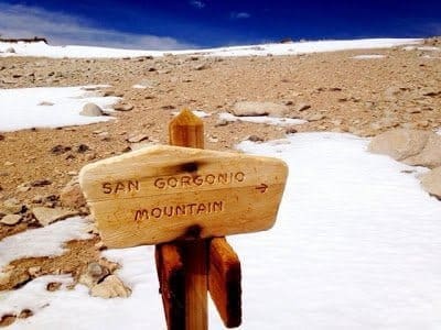
Best route to summit San Gorgonio in the winter
Some winters you can find me on the trails of San G twice a week. San Gorgonio has to be one of the most fantastic and challenging hikes in all of southern California. If you manage to summit Old Greyback you are looking at standing on the top of the highest mountain in southern California at 11,503 feet. It is quite an accomplishment. A lot of people choose to hike this majestic mountain as a day hike, and a lot of people would rather do it as an overnight hike. In the cold and snowy winter months, you see just a few brave soles choosing to overnight San G, braving the cold, the snow and the crazy wind chills at the summit. If I hike up one of the trails traveling up to the peaks of San G on a weekday there is a chance I will not see another hiker all day. That’s how secluded these trails are. And I love it that way. Anyone can go for a hike in Carbon Canyon or the hills above Laguna Beach and see one hundred people in a two-mile hike. I adore hiking at San Gorgonio in the winter months because the wilderness is desolate, silent, peaceful and it feels like I’m the only one on the mountain.
When researching a hike into the San Gorgonio Wilderness in the winter months, you may be put off by the thought of hiking in so much snow. What I like about hiking in the San Gorgonio Wilderness in southern California is we do get snow but not as much as other areas of the country. Southern California, unfortunately, does not get the snowpack of the eastern sierras and that means that the lower sections of all the trails leading to the peak of San Gorgonio are very hike-able even in January and February each year. If you plan a hike up into the San Gorgonio Wilderness after the weekend following any snowstorm, I guarantee the die-hard hikers and the locals will have already been out hiking, snowshoeing, cross-country skiing and yes, even snowboarding in the San Gorgonio Wilderness and what the means is that the trails will already be blazed for you and you will have no problem finding the popular trails leading to the snowy summit of San G.
Vivian Creek Trail
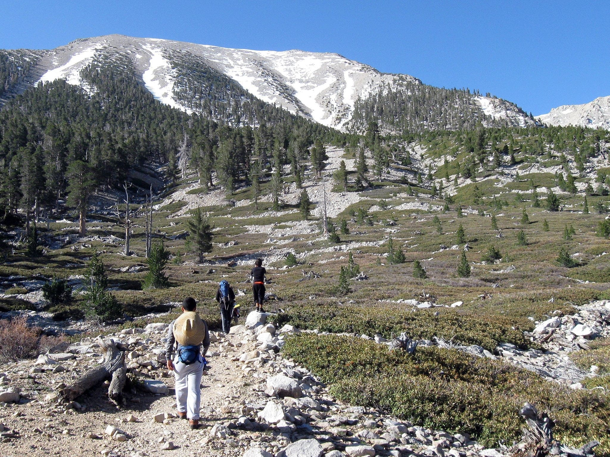
Vivian Creek is the most popular and straightforward way to ascend Old Greyback. It seems like an easy hike in the beginning; The first time I tried hiking up Vivian Creek I remember thinking at mile one, how easy the start of this hike is. You cross a babbling creek or raging river depending on what season it is. The river bed is filled with gorgeous granite rocks of every size and color, and you hope, fingers crossed, no rattlesnakes today. (There never are in the winter months, one of the reasons I love hiking in the winter) Then you cross the creek and enter the forest and the trail kind of meanders a bit, and it might get a little buggy here depending on the season. The path up the mountainside gets steep from here, and your calves will start burning early into your hiking day. This is one of the hardest parts of the hike and the place a lot of beginning hikers give up. It’s a brutal mile hike uphill (Where you gain 1,000 feet altitude gain) from here to the first campsite at Vivian Creek Camp. After this, the hike gets easier for quite a few miles as you pass through dense pine and cedar forest. Past the second camp at High Creek, the trail begins to climb again, and this is where you get those phenomenal views of Manzanita covered Jepson Peak and snowy Galena Peak towards the mountain hamlet of Forest Falls.
There are some gnarly switchbacks at this point, and if there is a lot of snow on the trail, this is usually the point where the snowshoes are strapped on as you make your way up towards the ridge that leads to the summit. There is sparse vegetation at this altitude, and this makes the views of San Jacinto out towards Palm Desert just phenomenal. If you were to hike this section in summer, this section of the trail can get hot, but in the winter you usually get cold wind gusts from the summit. Vivian Creek is the shortest way to get to the top of San Gorgonio and by far the most traveled but trying to summit this route in the winter, the trail is never very crowded, even on weekends.
Momyer Trail
This is Momyer Trail that visits Alger Creek and eventually eleven miles and 6,913 feet later the top of San Gorgonio. This is the route to the top of San G with the most eventual altitude gain. It is also one of the longest routes; some people say it can be done in eight hours. (They may be crazy trail runners though) The San Bernardino Peak Trail cuts off at about 6,500 feet and veers to the east. (But this trail is not maintained for a few miles and is extremely hard to follow in the winter months unless you know it well) This is well known to be one of the steepest trails around. After 8,000 feet the trail goes pretty much straight up for a thousand feet; so I have heard, I have never actually made it that far. (I’ve hiked about nine miles up this route on my farthest days) It was hard enough to hike this peak on a February morning; I can not imagine people backpacking this in June with the hot temperatures!
The beginning of this hike crosses Mill Creek, which is just a babbling brook and easy crossing. After this, you wander through a scrub oak forest where seeing deer in the morning is common. After this point, the meandering woodsy trail leaves the creek beds and granite strewn area of the forest behind, and you slowly work your way up to a dusty trailside in full sunlight. There are about six switchbacks you sludge up in full sun, no shade to be found until a few corners up when you enter a deep shrub oak forest again. There is usually no snow at all on this part of the trail. The trail gets steep for miles from here on up as you make your way towards the cutoff for Alger Creek Campground. Eventually passing the cut off for San Bernardino Peak after that. That is about the time the views up here get truly phenomenal, and the snow gets deeper. Either strap on your crampons or snowshoes depending when you need them. You pass the trailhead to Dobb’s Camp to the right at this point, and a few miles after that is Saxton Camp. Saxton Camp is at the 7.4 mile mark, and I have only made it a few miles past this as I’m a day hiker, and you can only hike so many miles in a day (Especially in the snow. Hiking in the snow will slow you way down, especially when the snow gets deeper) If you wish to go farther here it is about 2.3 miles from Saxton Creek Camp to Dollar Lake Saddle. A warning though, the Dollar Lake area was damaged by the Lake Fire in 2015, and this area was devastated, and the views I am sure are not what they once were. If you do keep going from this point, it’s just over three miles to the summit.
About a miles hike above Dry Lake is an area of the forest so stunningly gorgeous that we just refer to it as “Winter Wonderland” Winter Wonderland was truly one of my favorite areas to visit in the winter months in the San Gorgonio Wilderness, and it breaks my heart to know that area burned so terribly in the Lake Fire. Although this hike up to this elevation above 10,000 feet was super hard and even shortcutting it up Lost Creek Trail meant an 18 mile round trip day hike, I must have hiked this route twenty times in the winter and spring before the Lake Fire.
This area of trails; South Fork Trail, Lost Creek Trail, and Fish Creek Trail through the aspen groves are all still closed by the forest service since the fire. Hopefully, in the coming years, the forest service will reopen them, and the San Gorgonio Wilderness Association can start rebuilding the trails destroyed in the wildfire. One of my favorite routes into the San Gorgonio Wilderness may be out of commission for a few years, but there are many other options for an outdoor adventure kind of day out in the wilds of the forest. Pack your snowshoes, your trekking poles, maybe even your cross-country skis and get outside and explore the San Gorgonio Wilderness this winter season!
Pin It!


Excellent write up. Thanks.
South Fork trail opened up July 2017. The trail goes through several miles of burn area but the “winter wonderland” you describe (officially known as Trail Flats) was untouched by the fire and the views in April 2018 were beautiful even though the snow was very light this year. Also great views from Dry Lake and the hill just north of Dry Lake.
That’s awesome to hear the area survived the fire! I’m hoping to hike Lost Creek here in a few weeks once it’s more springlike at 7,000 feet. I have not been up there at all since the fire. I did hike a bit of South Fork a few weeks back and it’s just devastating what the trail looks like now.
Hey Amber,
I’m thinking of hiking to the top early in January, weather dependant. Have you hiked it in a first week of January? Is it ‘too early’? Also – question on snow shoes… I’m travelling from Europe so I will not pack a pair of snowshoes just for a day of hiking 😉 Are they really necessary? Will mini-crampons not be enough? I read your article and it seems that the trail should be passable providing other hikers go up there before me.
Any suggestions will be greatly appreciated!
Nice article. Face protection is a very good suggestion. I’ve sumitted San Gorgonio twice this year. When reaching the summit last February the 20 – 30mph winds brought the windchill to zero and below. My high plans of busting out the Whisperlight stove and having a cup of coffee and hot breakfast were quickly extinguished when I relaized I was loosing use of my fingers when I took my gloves off to take some photos, and I had only an extra pair of fleece longjohns to wrap around my face.
Here’s my take, although I know folks will hike there own hikes. For the February trip a friend and I hiked up to High Creek Camp via the Vivian Creek trail, made camp and then summitted the next morning. We then hiked back down to camp, packed up and hiked out.
Then a few weeks ago (end of November) another friend and I also hiked up to High Creek Camp, set up camp and then continued on and summited that same day. It was late enough coming back to camp that we hiked down by headlamps the last few miles. We then crashed at camp and hiked out the next day. I would not have summited anticipating a night hike return if that section of the trail had ice on it, which it did not.
My next trip in January or February will be 3 days, 2 nights so I can get to HC camp, set camp, relax and hang out the day and night, and then summit and return to camp day and night 2; then hike out the 3rd day.
I figure it takes me 3 hours to get to the ranger station from my house and then another hour to get the permit and get to the trailhead with my pack on. It is then a 6+ mile hike that ascends 3000′ to HC camp. With a 30+ pound winter pack on… I’ve learned that’s enough for me for one day.
The next day will be a relaxed mid-morning start to the 5 mile, 2400′ up and 2400′ back down, to and from HC camp.
I’ll Bring a stove to the peak, make something hot to eat and drink and kick back for a while and enjoy (if the weather is hospitable).
For Amber that posted a few weeks ago… It is tough to know what to bring this far in advance of a January hike. Suffice it say that microspikes and poles may be enough but, crampons, axe and snowshoes might be advised. And, if you get the wrong snow conditions with high avalanche risk you may just opt for the beach instead.
My research of San Gorgonio introduced me to the stories of the 2005 (I believe) when multiple deaths occurred on the mountain due to ice slip and falls. According to what I read, all but one of those 5 hikers were experienced hikers, and most all had appropriate gear and experience. One was trying his first hike using crampons.
It is beautiful mountain. Be safe and enjoy.