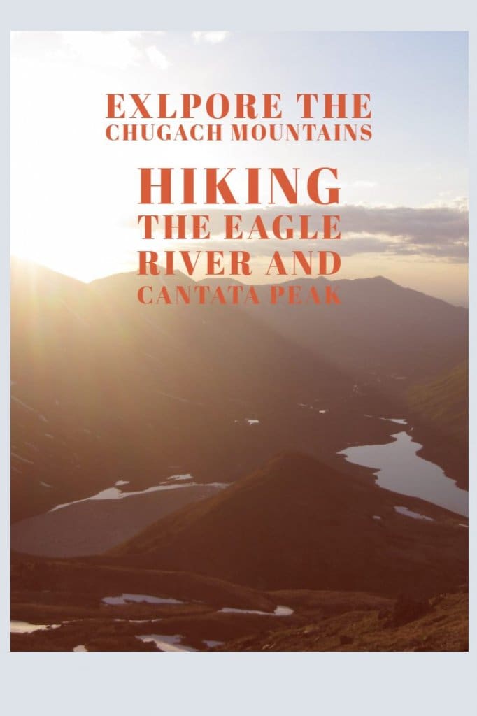
Hiking the South Fork Eagle River & Cantata Peak
Join us as we explore the Chugach Mountains and experience the beautiful Wilderness of Alaska. Pack your Hiking poles, some comfortable hiking shoes and join us as we explore the south fork Eagle River and Cantata Peak.
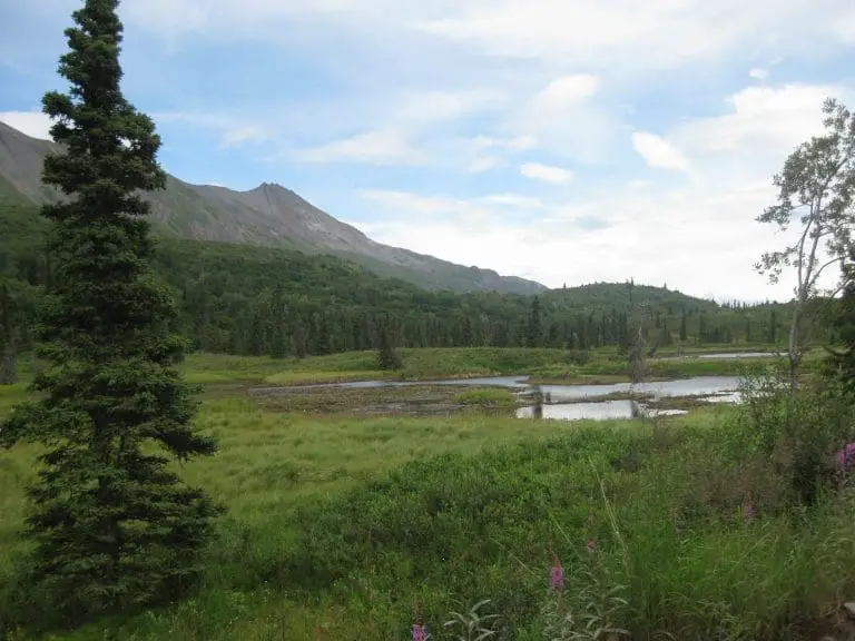
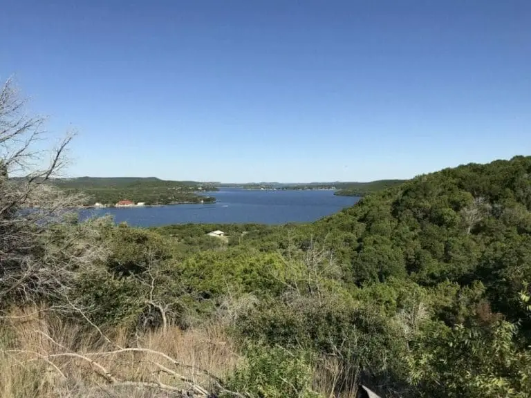
Chugach Mountains
Weather
Weather for Anchorage Alaska – Nearest reporting weather stations.
Parking
Parking is available at Chugach State Park
Directions
Many of these passes and trails are accessible from the Chugach State Park located at 18620 Seward Highway, Anchorage, Alaska 99516
Click on Directions on the following map to plan your route to the park.
Webcams
Trail Map
PDF Map of Chugach State Park
Into the Wilderness of Eagle River
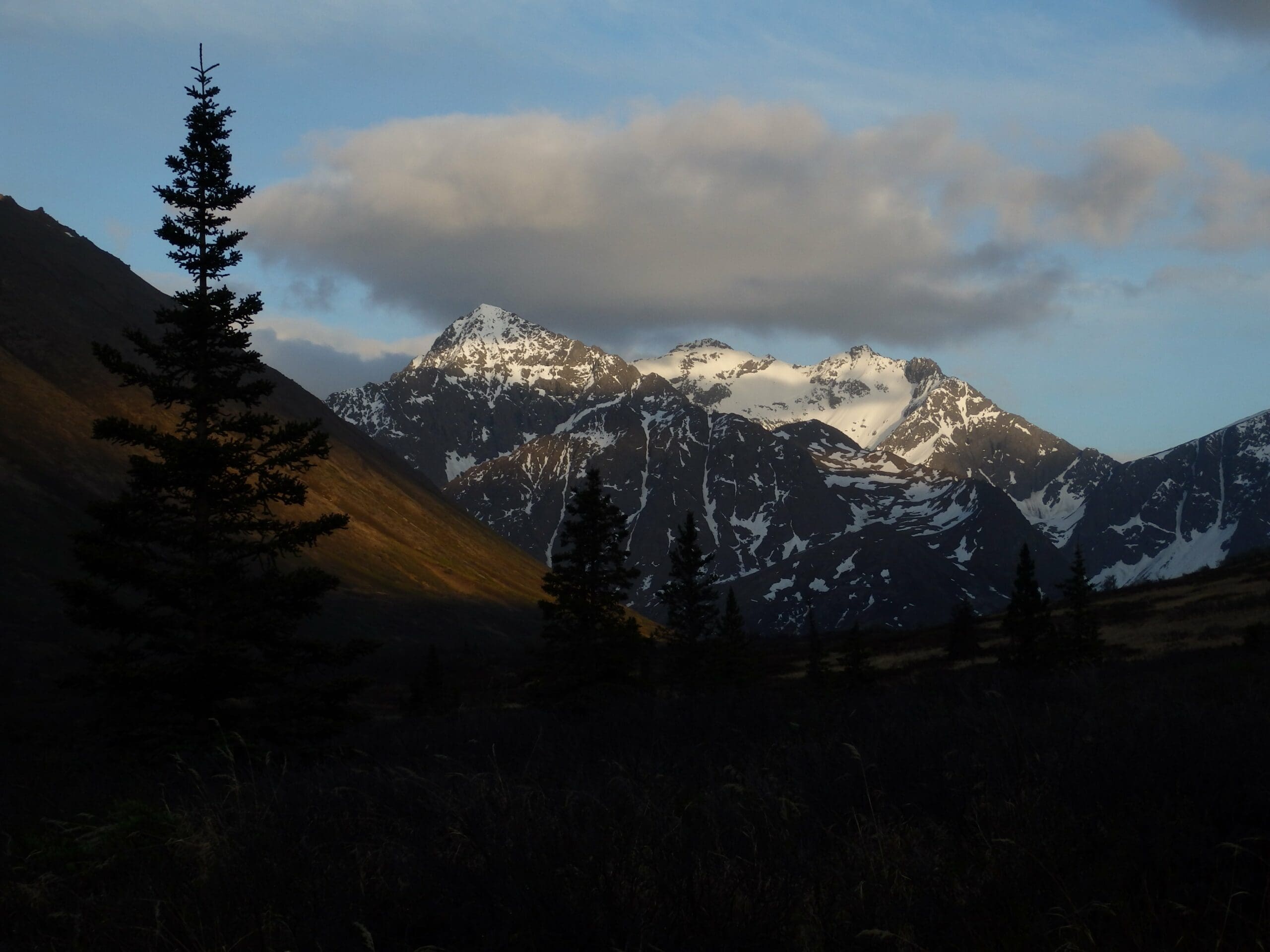
This mountain just kept going up. From the valley floor to the glacial moraine and now, at last, to rock slopes. The three of us clung to the side of Cantata Peak in the western Chugach Mountains, not too far from Anchorage. I was eighteen years old, and this was my first real mountain. Few people ever climb Cantata, even though the access route is remarkably easy, a relaxed hike south through the valley of the South Fork Eagle River. Eagle and Symphony Lakes are common campsites in the summer, but Cantata, which rises sharply from the south shores of those lakes, normally remains as little more than a beautiful decoration.
But we were here to make an ascent.
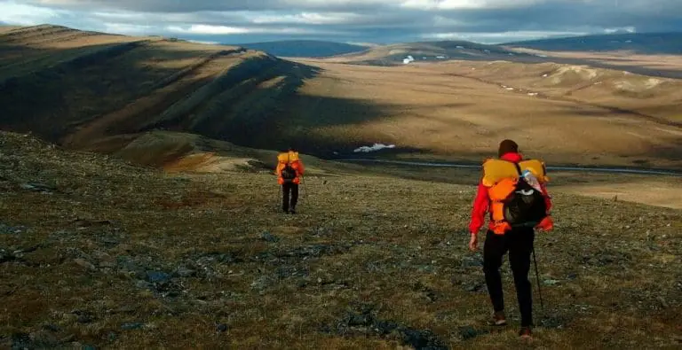
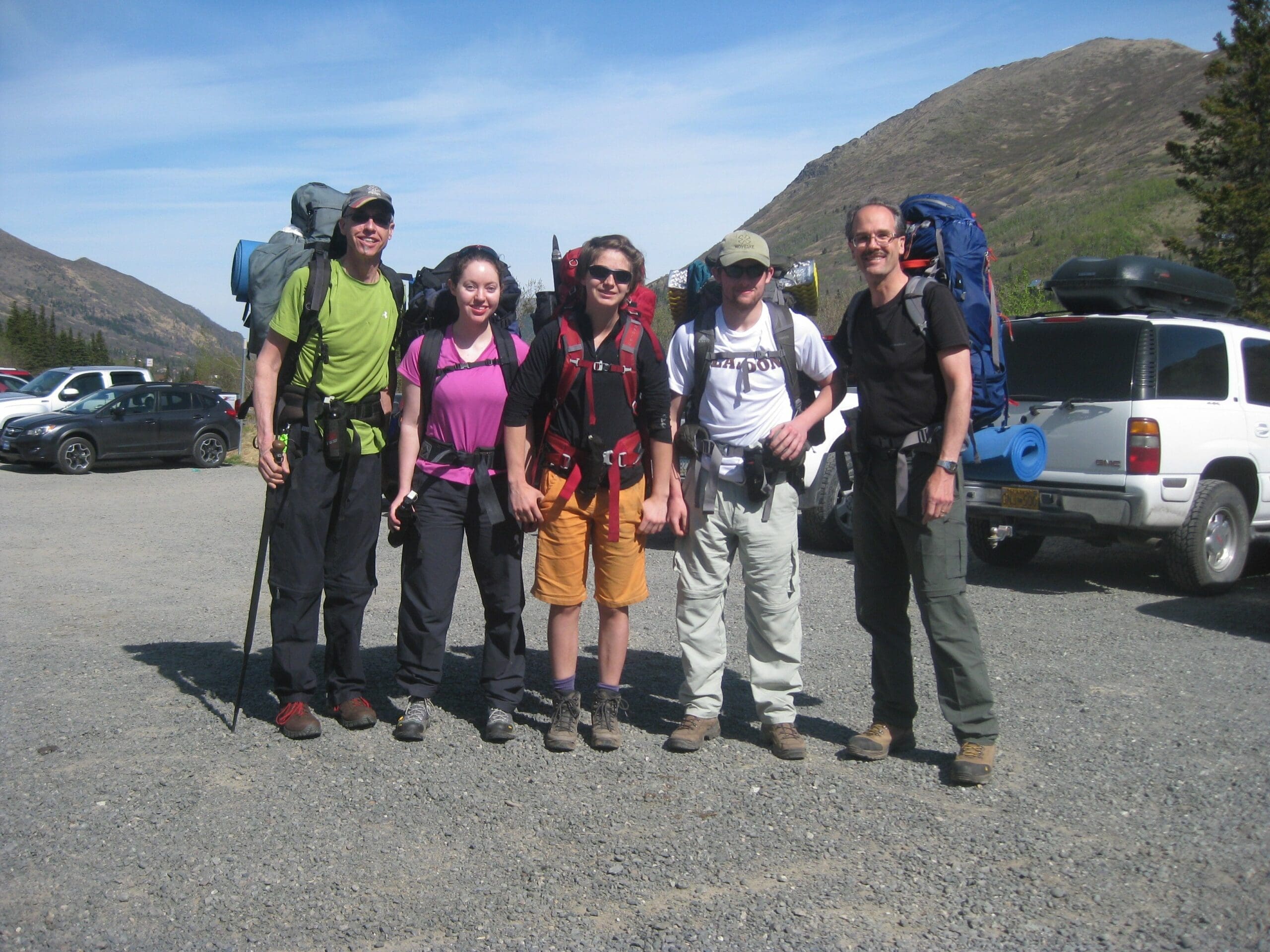
We had set out the day before, a group of five at the trailhead, just a few miles south of the town of Eagle River, Alaska. The trail started easy, flat, and wide at the edge of the tree line. Though it was May, early in the hiking season, we were not alone on the trail, as it’s a common and popular route into the Chugach Mountains.
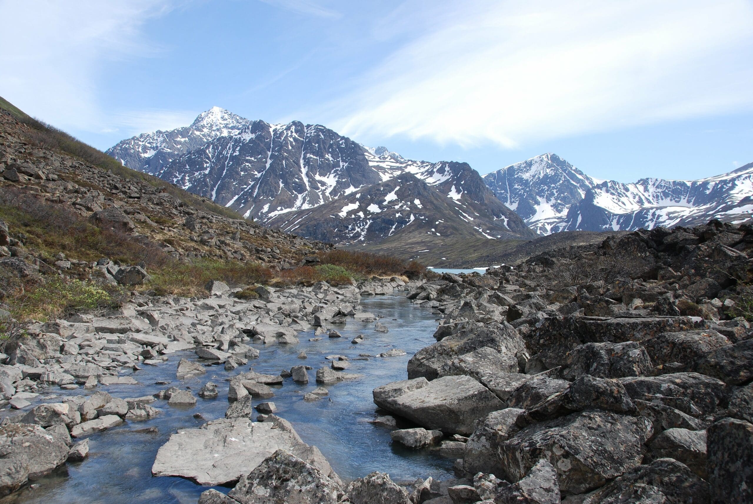
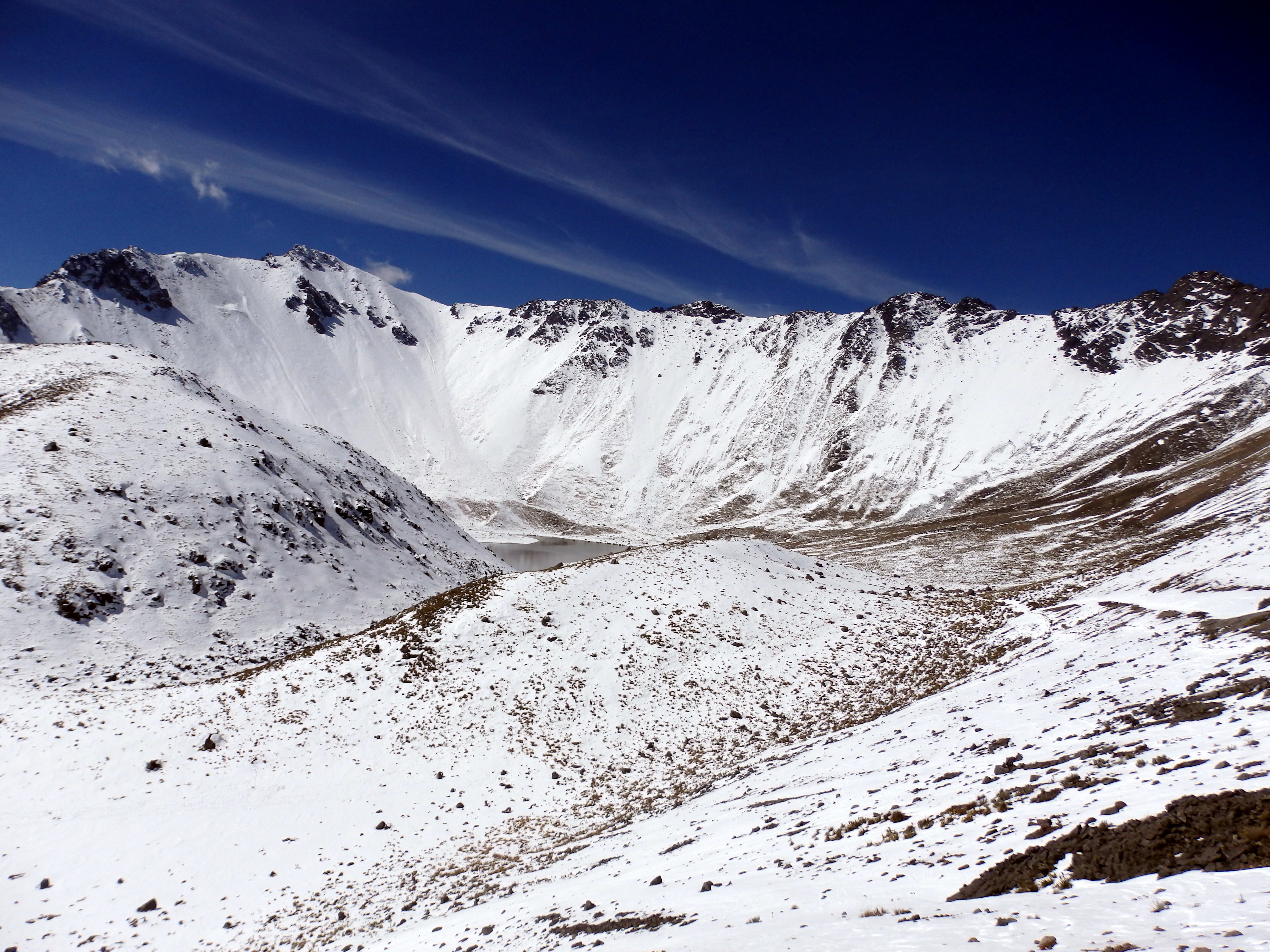
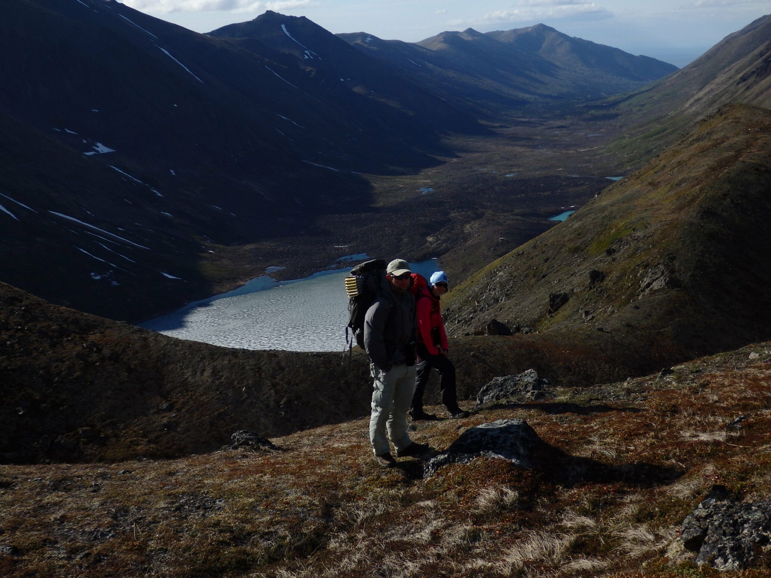
Tall, snow-covered ridge lines lined the valley. These ridges stood almost as guardians of the mountains, massive and silent giants frozen in place. Under the heavyweight of our packs, we made our way along the trail until we finally left the trees behind and stood amidst open alpine tundra. And then we left the trail on a glacial moraine between Eagle and Symphony Lakes. The trail wraps around the west side of Cantata, but we were on our way up.
The climb to our campsite was a struggle, steep tundra on the side of a mountain. Worse, the terrain had been shaped by a receding glacier thousands of years ago, meaning that the land had an undulating nature to it. Twenty feet up, ten feet down. And again. And again.
Camping in South Fork Eagle River
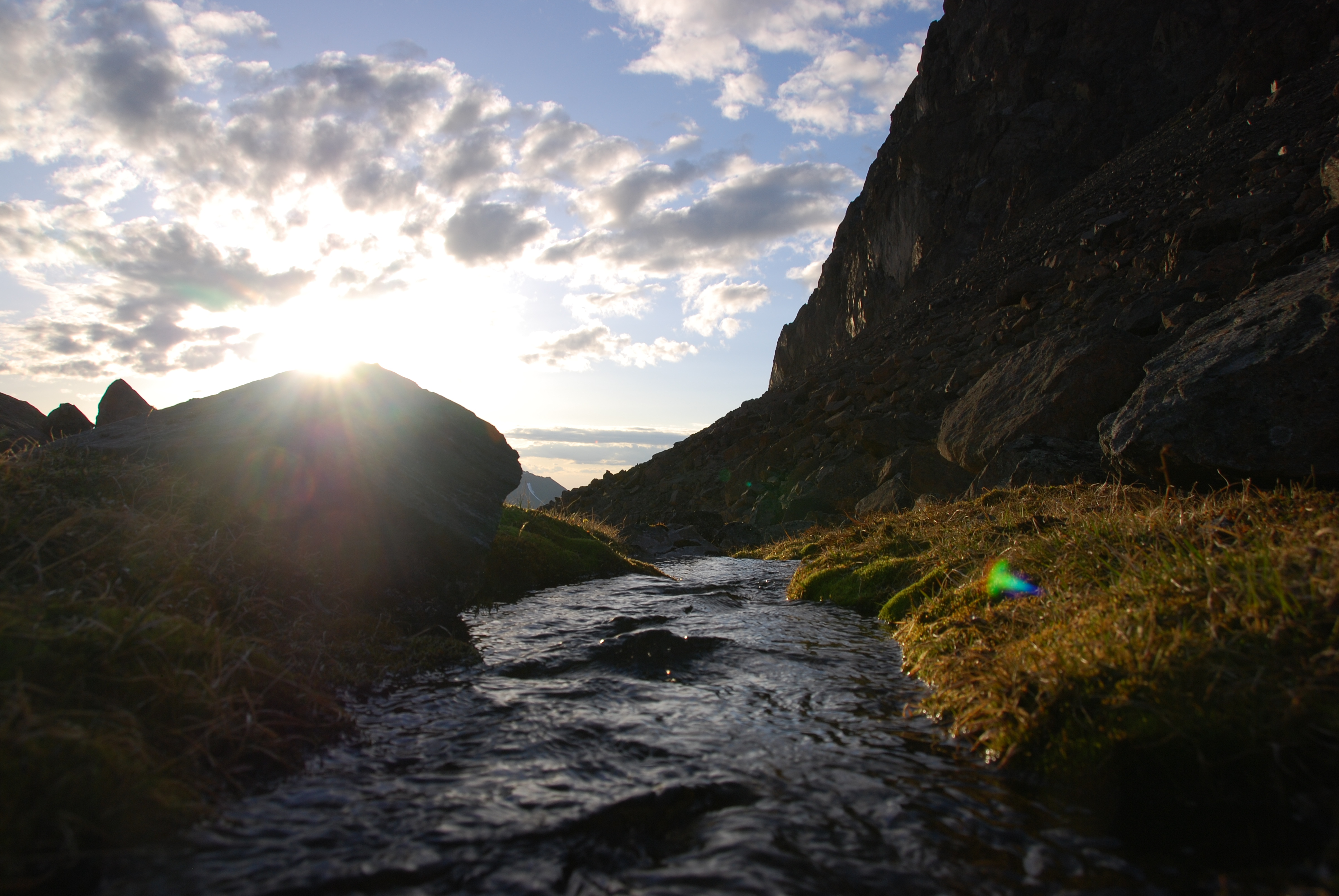
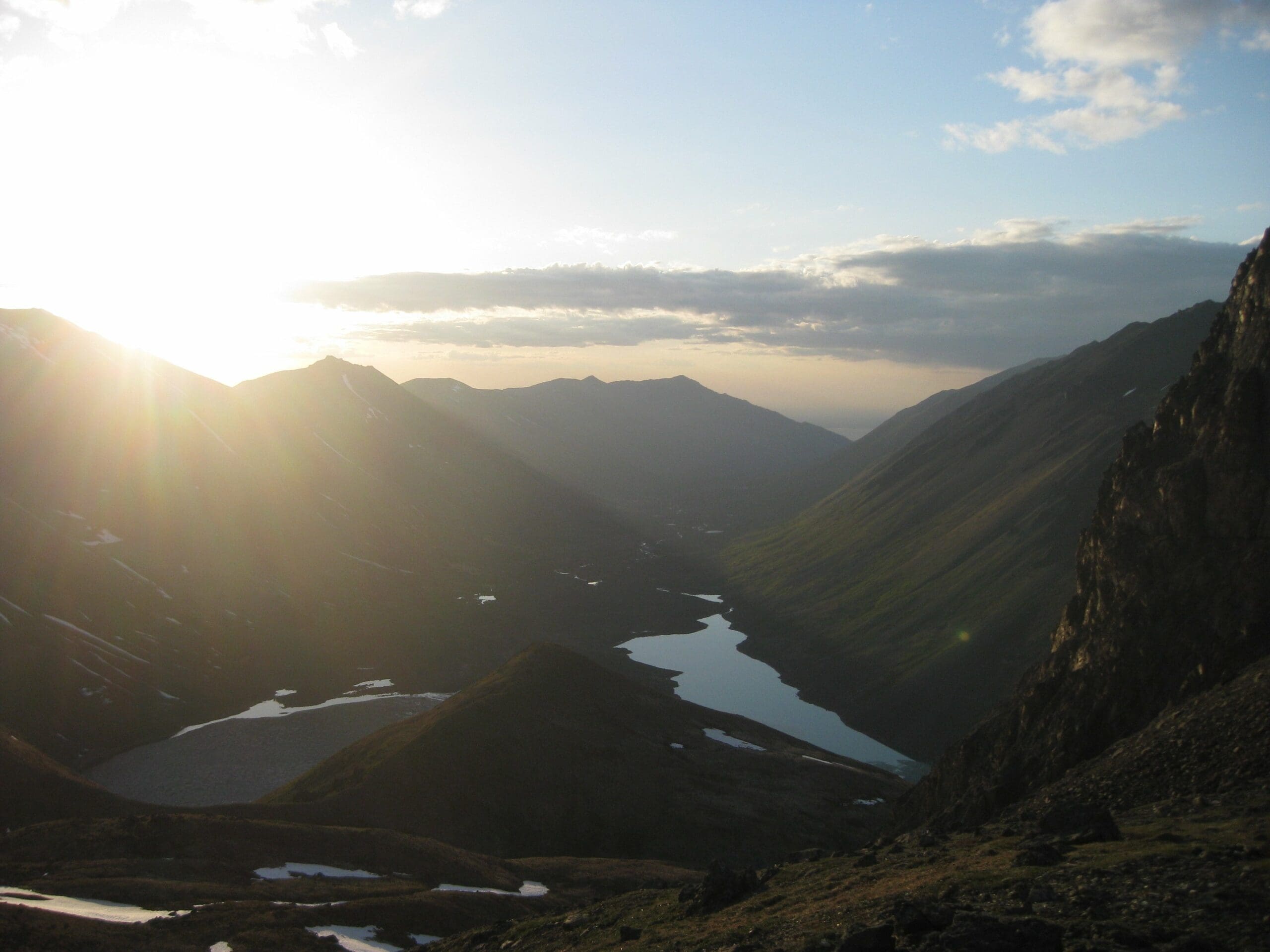
And then it was flat; we had arrived at the point where that ancient glacier had ended. And we stood there, at about 4,500 feet above sea level on flat ground, with the sides of the mountain rising all around us, engulfing us. It was there that we set up our camp for the night.
We were lucky. Unspeakably lucky. Despite our placement on the side of a mountain, we had fresh, running water coming directly from a nearby snowfield. Later in the season, when the snow is melted, this place would be a desert, utterly unlivable. But right now, we had water, water clean enough that I trusted it without filtration or purification.
Our tents stood side by side on the tundra, one blue and one orange, strange juxtapositions against a wild landscape. And to our north, the river valley stretched out before us in one long steak of wonder.
The Sunset Sky of Alaska
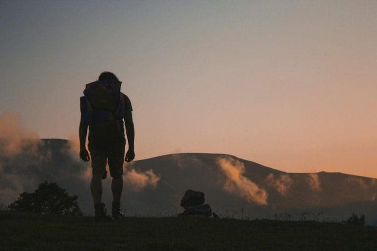
Here’s a kind of weird fun fact about Alaska, or anywhere in the far north for that matter. Near the summer solstice, the sun rises and sets in the north. The sun will seem to skip off of the northern horizon in late June, giving you days of pure light. And here on our mountain, we sat and watched the sun do just that. The orange blaze of light barely touched the northern horizon.
The colors were amazing, brilliant oranges and yellows, worthy of painting but instead only captured by cameras. It was with that brilliant light that I fell in love with the wilderness. This was my first time honestly outside. Not just in the woods, or a few miles from a road. I’d been backpacking in West Virginia and North Carolina before this, but never had I stepped foot in true wilderness.
There was and still is something special about this place to me. The way the sun danced on the northern horizon, turned the sky the type of color you see in a movie when a hydrogen bomb goes off. The valley we had hiked through earlier that day lit up end to end by the blinding brilliance. None of us could look away. None of us could do anything but watch the northern sky as the sun went lower and lower.
I cannot drive those memories away from me, and I do not want to. The sight of the setting sun in the north, the gurgling stream coming from beneath the last of the winter’s snow. And spending that time with people, I care about. I mentioned that for the final ascent there were three of us. But at this camp, there were five: my father, his brother, my sister, an exchange student, and me.
This memory is special to me because it represents spending time with great people in a great place. The hike up to this camp with full backpacks had been rough during that last climb up the moraine. But it was fantastic. Even though my legs were sore from the climb and my hands a bit singed from some mistakes while cooking dinner.
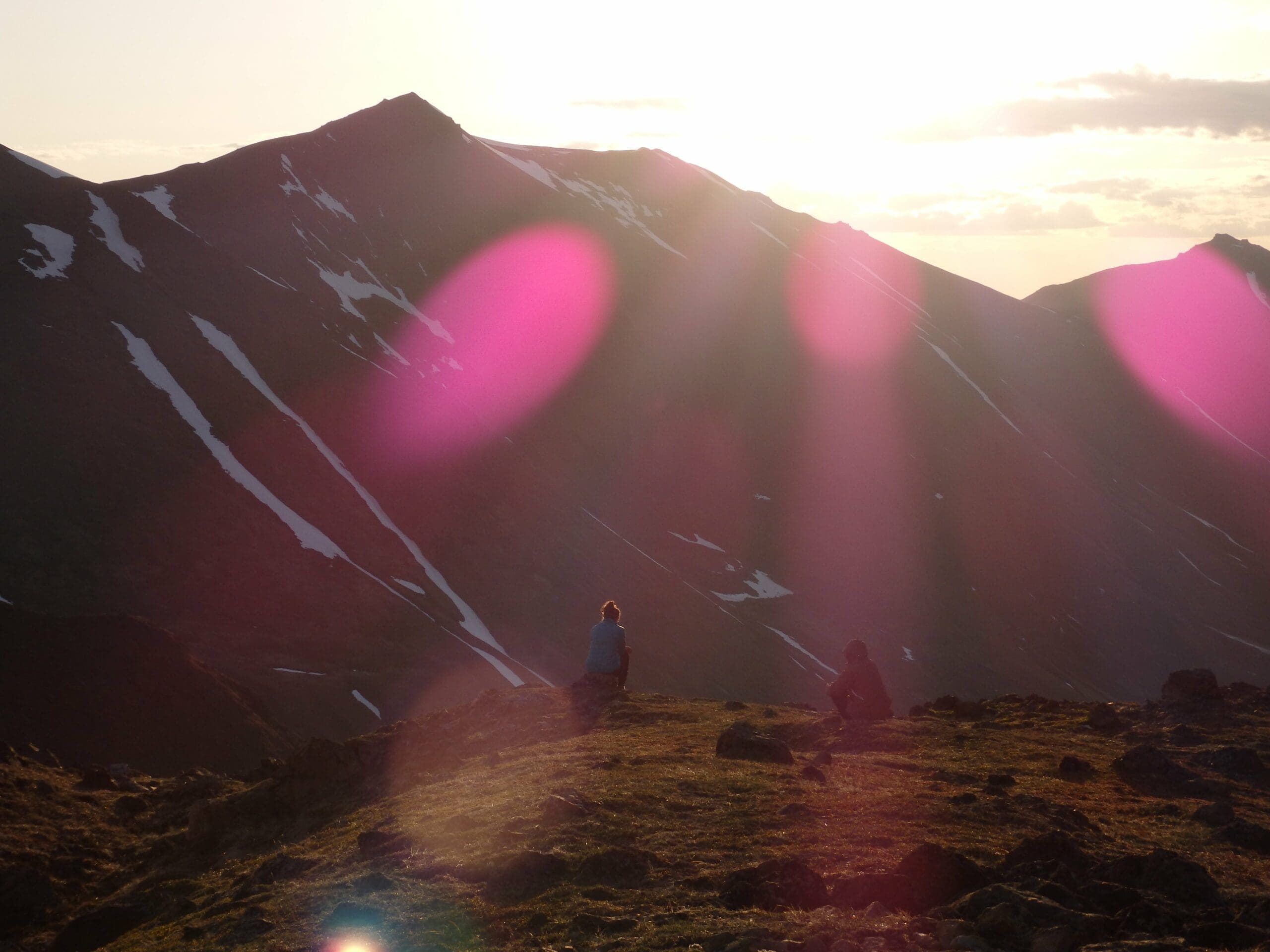
After a while, a cold wind whipped up from the nearest ridge and forced us inside our tents, but we were far from done for the night. We played a card game for about an hour by headlamp light. I remember that is called Presidents, though I cannot remember how exactly to play it now, almost four years later. And when that was done, I stepped outside again and gave a final, long look at the sun low to the north. The sky now less brilliant orange and yellow and now more mixed. The northern sky now a pale Naples yellow, which faded to a light blue, then darker, and at last, to the south, a deep purple. And in that part of the sky, the stars were bright. All together in one sky at one time, a setting sun and constellations of distant stars, all a key part of the wonder of the far north.
Ascending Cantata Peak
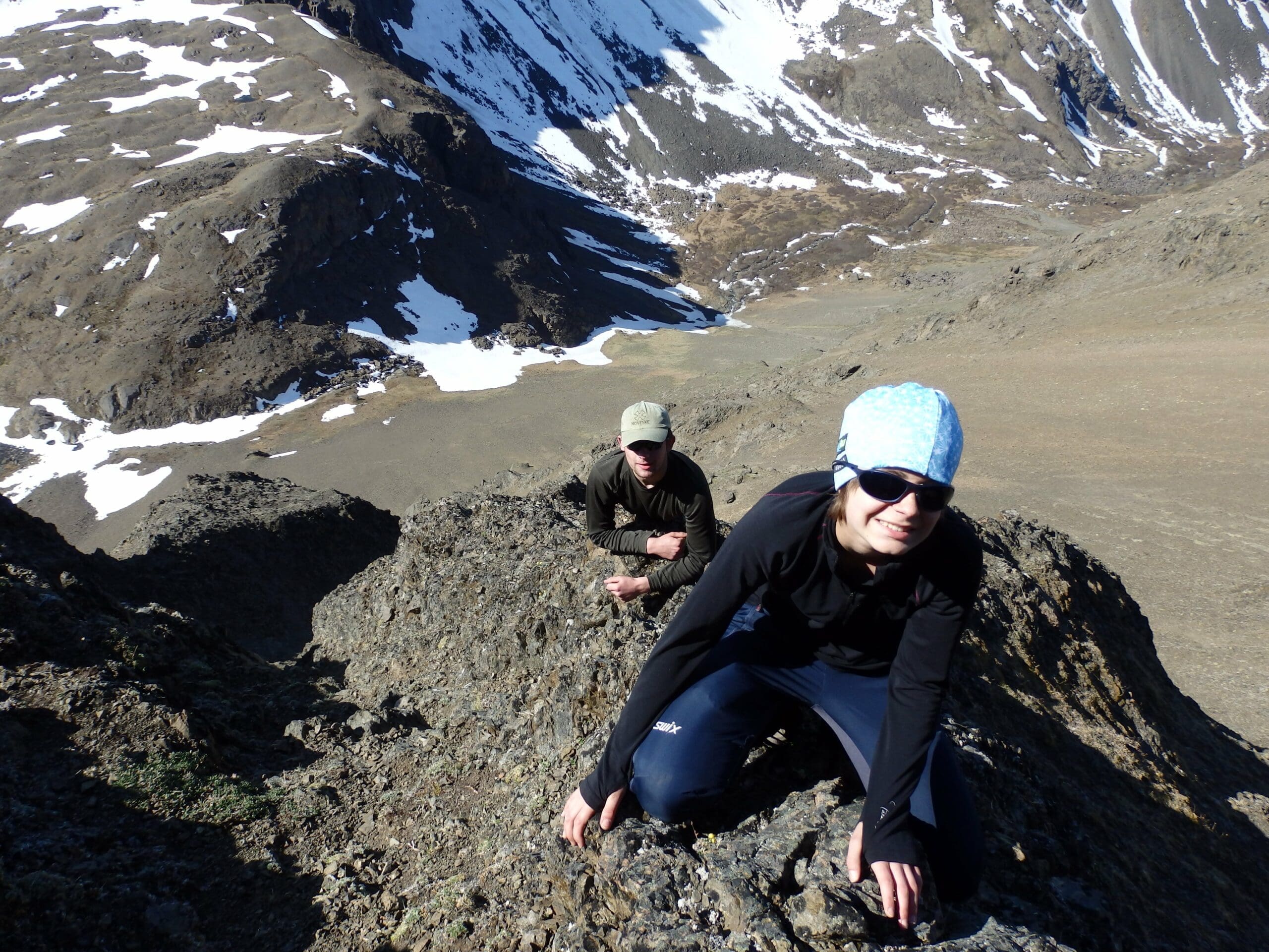
We rose early in the morning, with the sun already fully risen. Leaving our tents and other heavy equipment behind we began our climb, up and up the ridge above our camp until finally, we stood atop it. And from there we followed the sharp ridgeline itself, south, then east. Cantata Peak itself now stood massive before us, a slab of ancient rock. And then we were at the final part of the ascent.
There is a place on this mountain, and I believe this place is the reason, so few make the climb, where the stone rises sheer in front of you. There appears to be no possible safe way to make it past this rock wall, especially since the rock in the Chugach is referred to as ‘Chugach Crud’ because of how easily it breaks apart. It was at this point my father and sister turned back to our camp. This is not a critique of their choice, far from it. One of the most important aspects of staying safe out in the wilderness is knowing your limits.
My uncle, who had been here once before knew the route, but also knew that the rock was class four, non-technical yet exposed. If you’re unfamiliar with rock classifications, there are five classes, with class five itself subdivided to mark differing degrees of technicality. Class one is like a staircase; two is a bit more, three is a scramble, four is a real challenge. Five requires a rope and harness to be done safely. I’m a backpacker, not a rock climber, so even to this day, I stick with class four and below.
He led the way, with me and the exchange student following behind. We hugged the rocky sides of the mountain and climbed slowly. Neither of us was particularly experienced, so we took our time on the way up, wary of any slip. A fall here would have… less than pleasant results.
Don’t want to get lost or lose the trail? Check out our guide on the Fenix 7 Outdoor watch and how it can help you on your next adventure.
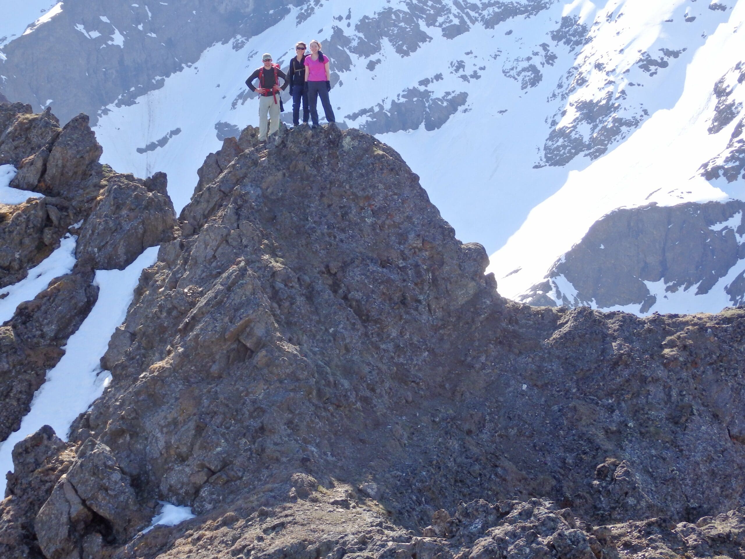
Cantata Peak
There was one particular moment that sticks in my mind. We arrived at a chasm. A sort of gully in the rocks, steep and narrow. I went up last. The rock was tight around me, almost like being in a cavern with three sides open. Above me, blue sky. To my front, my left, my right, solid rock. And behind and below me, nothing. Nothing at all.
And I was afraid — an eighteen-year-old kid from Maryland, on his first real mountain. But then I was through it. I was standing on a relatively flat section of rock, with the summit nearly in sight. That moment of fear lasted only for a few seconds, but it was very real. Fear is a survival instinct; it will keep you alive in dangerous places. And here it had propelled me, almost without conscious thought, right through that rock channel. I do my best not to have to rely on my fear, but it’s not a bad backup for when things get interesting.
The three of us made our way now to the summit. Six thousand, four hundred, and ten feet above sea level. The view was magical. To our south, we could see, believe it or not, all the way to the eastern edge of the Aleutian Range. And to our north, the Alaska Range owned the horizon. And there was a large, white mound right in the middle of it. Denali looks like a cloud when you first see it, so perfectly white. So tall, it cannot possibly be a mountain.
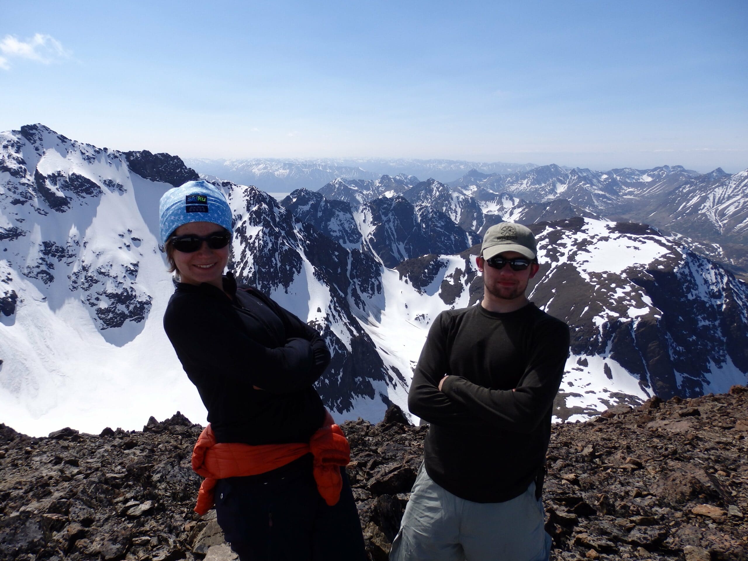
A View of ‘The Great One’
But there it was, the highest point in North America, and we could see it from Cantata Peak. For reference, the distance between Cantata and Denali is about two hundred miles in a line. Compare that to the distance between Washington D.C. and Richmond, Virginia, at only one hundred miles. And yet the mountain is so massive that even at that distance, it owned the horizon. That was all it took. I was addicted. Denali National Park has since become a minor obsession for me. The Mountain, with a capital M, will always stand as a symbol of America’s wildlands. Denali translates from Athabascan as ‘The Great One,’ a name it truly earns, though other peaks bear the name as, typically because of their unmissable appearance.
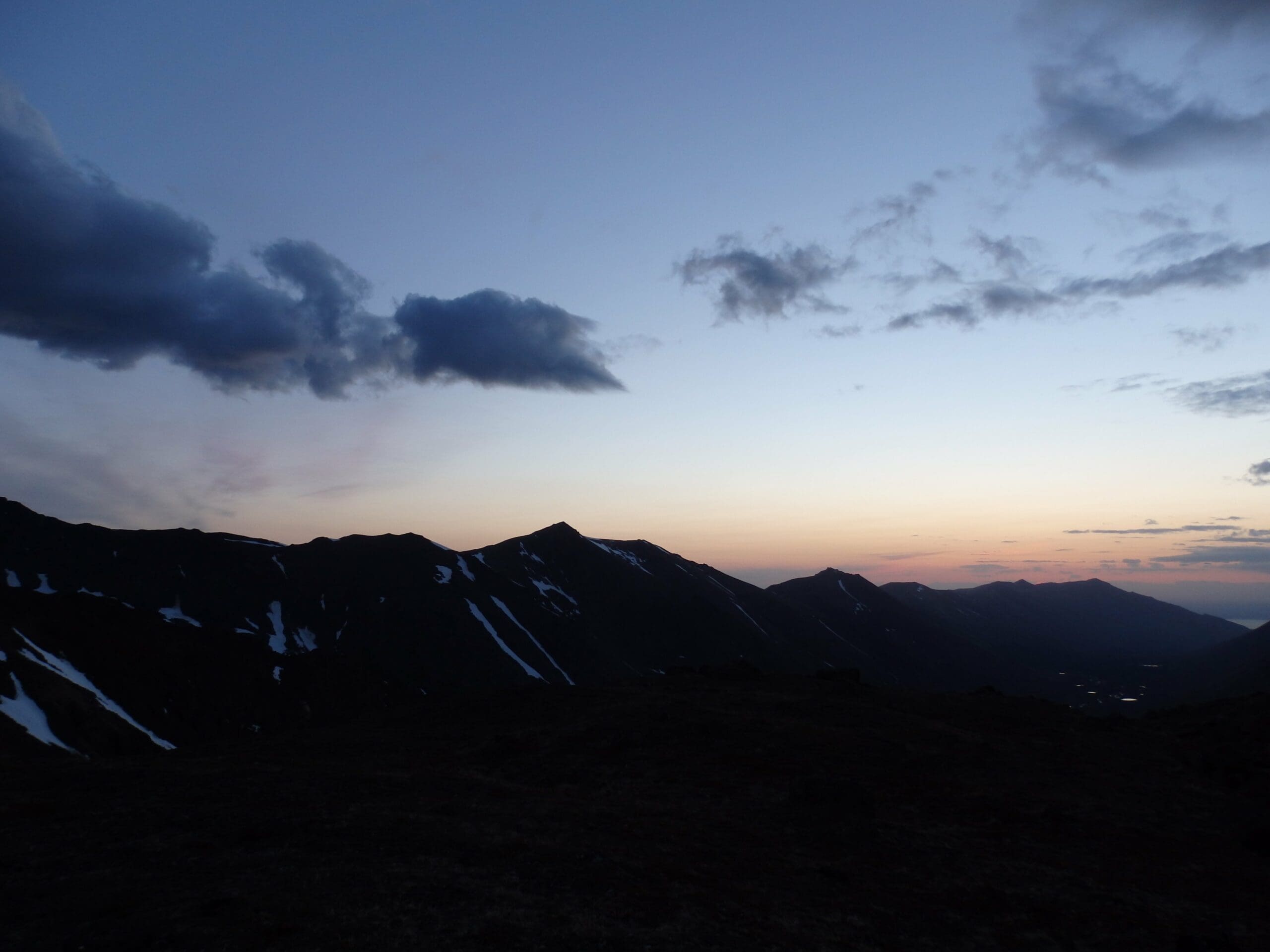
We posed for some pictures and spent a moment to admire the view before stepping off again. We had to be back in town by the end of the day. The way down flew by. We met my father and sister at our campsite, napping in the sun. There we all packed up our things and descended again to the trail by Eagle and Symphony Lakes. As we made our way north through the valley, the sun began to set. For the second time, the light illuminated the valley in vibrant colors.
Home Again
We hiked through the golden hour as the sun hung low over us to the north. Back over the tundra back through the low spruce forest right at the edge of the tree line. We moved quickly along the trail, this time alone. No one else was there as it was a Sunday evening with a workday coming up. We were in bear country again, and I will never forget the song we sang to scare off any potential wildlife threat. Check out our piece on Bear Safety for some tips on staying safe around bears.
The hot new movie was Disney’s Frozen. Yeah, Frozen, and I still love this movie. And so we sang Elsa’s song, Let it Go as our bear call. If you’ve never heard this song, you owe it to yourself to listen to it. But needless to say, I now associate this song deeply with the Alaskan wilderness.
And so we sang that song in an endless loop until we turned a corner and found ourselves standing in the parking lot at the trailhead. Our adventure was over, but those two days served as my introduction to the true wilderness. This has become an addiction for me. I cannot forget, I do not want to forget, that weekend. It truly did change me.
This single hike and climb re-framed my way of seeing the world, and each time I step off into the wilderness since then, I remember the feeling of awe I experienced near and on Cantata Peak.
FAQs
Are pets allowed on these trails in the Chugach Mountains?
Pets are allowed while on a leash. Please clean up and remove all pet waste. Leave no trace.
Are there Bears in the Chugach Mountains?
Yes. Check out our guide on bear safety! Always be prepared for wildlife when exploring the Alaskan wilderness.
Can you have campfires?
Campfires are allowed in portable camp stoves and in the provided camp rings within the state park.
Do I need a permit to hike the Chugach Mountain trails?
Permit is only necessary for groups of 20 or more.
Pin It!
Exploring the Chugach Mountains and trails can be an exhilarating experience. We value reader feedback immensely. Share your experiences, updates, and tips in the comments section below!