Ever since my childhood trips to the Rockies, I’ve been enchanted by the thought of conquering mountains on foot. It was in July of 2018 that my dream turned into reality. During a one-week getaway to our favorite mountain town, Breckenridge, Colorado, my family and I set our sights on the majestic Quandary Peak. This hike not only promised breathtaking views but also a fulfilling challenge.
Fast forward to 2024, and the allure of Quandary Peak still captivates me. I’m eagerly planning to revisit this iconic summit and other 14,000-foot giants in Colorado. Whether you’re preparing for your first ’14er’ or looking to revisit the trail, this guide offers essential tips for tackling Quandary Peak.
Quandary Mountain
Mt Quandary at a glance
- Summit Elevation: 14250 feet
- Location: Tallest peak within Colorado’s renowned 10-mile range, approximately 9 miles south of Breckenridge.
- Elevation Gain: 3450 feet
- Hiking Difficulty: Very Hard
- Trail Summary: ~6.7 miles round trip · estimated 6 hours (my trip was 8 miles!)
- Best Season: Optimal hiking conditions from June to October. Winter adventurers will need snowshoes and appropriate gear.
Quandary Peak Trail
Nestled in the heart of Colorado’s rugged terrain, Quandary Peak offers one of the most scenic and exhilarating hiking experiences in the Rocky Mountains. Whether you’re a seasoned hiker or a photography enthusiast eager to capture the raw beauty of nature, Quandary Peak Trail presents a unique adventure that combines natural splendor with a rich history. Below, explore some fascinating facts about this beloved trail—from its community-driven maintenance to the vibrant wildlife that calls it home. These insights will enhance your journey and deepen your appreciation for one of Colorado’s most iconic hikes.
- Trail Origins: Quandary Peak Trail was established to provide accessible, yet challenging, access to one of Colorado’s famed ’14ers.’ The exact year of its opening isn’t well-documented in publicly available resources, adding an element of mystery and heritage to the trail.
- Trail Builders: The trail is maintained by the U.S. Forest Service, with frequent support from local volunteer groups. This highlights the community effort in preserving the natural beauty and accessibility of Quandary Peak.
- Notable Features: Quandary Peak is known for its relatively shorter yet steep route, making it a popular choice for those new to high-altitude hiking but looking for a real challenge.
- Fauna and Flora: The trail offers the chance to spot rare alpine wildlife, including mountain goats and ptarmigans, which are often seen in the rocky sections near the summit.
- Conservation Efforts: Local organizations such as the Colorado Fourteeners Initiative (CFI) play a crucial role in trail maintenance and conservation efforts, ensuring the trail remains safe and sustainable for future hikers.
- Ideal for Photography: With panoramic views of the Rocky Mountains and abundant natural beauty, the trail offers numerous opportunities for photographers to capture stunning landscapes and vibrant wildlife shots.
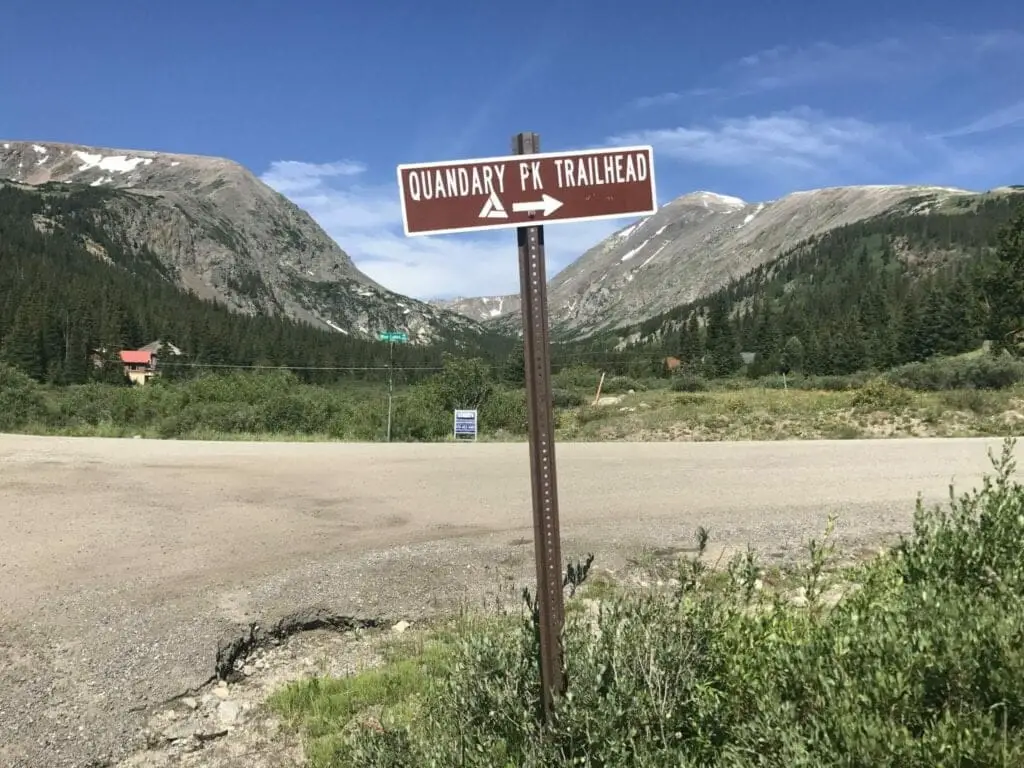
Directions to trailhead and parking
- Start in Breckenridge: Begin your journey in the heart of Breckenridge. You’ll need to head south out of the town.
- Take Main Street to CO-9 S: Head south on Main Street towards the south end of Breckenridge. Continue to follow CO-9 S.
- Continue on CO-9 S: Drive south on CO-9 S for about 8 miles. Keep an eye out for Blue Lakes Road (County Road 850) on your right.
- Turn Right onto Blue Lakes Road: Once you turn onto Blue Lakes Road, follow it for a short distance.
- Turn Right onto McCullough Gulch Road (County Road 851): Soon after turning onto Blue Lakes Road, make a right onto McCullough Gulch Road. This road is directly connected to the Quandary Peak Trailhead.
- Arrive at the Trailhead: The trailhead parking lot will be on your right. It’s well-marked, and you’ll typically see other vehicles and hikers preparing to start their hike.
Make sure to arrive early, especially during peak hiking season, as the parking lot can fill up quickly due to the popularity of the hike. Enjoy your adventure up Quandary Peak!
Use the Quandary Peak parking area map below to map out directions from your area!
Hiking Quandary Mountain
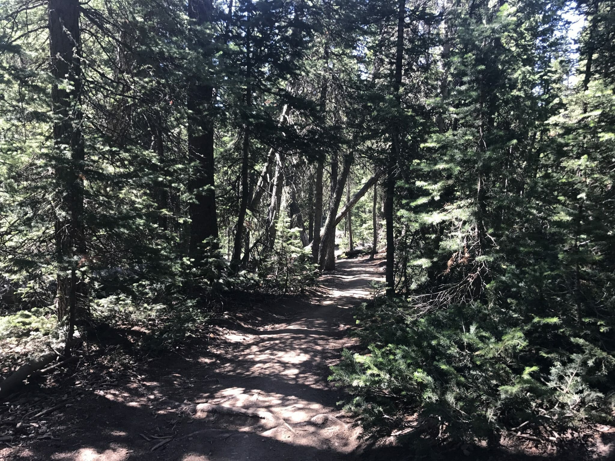
As soon as you step onto the Quandary Peak Trail, the ascent begins. From the outset, the path welcomes you with its pristine condition and clear markings, guiding you confidently through its lower stretches. The journey upward is as straightforward as it is breathtaking—ensuring you can focus fully on the beauty unfolding with every step
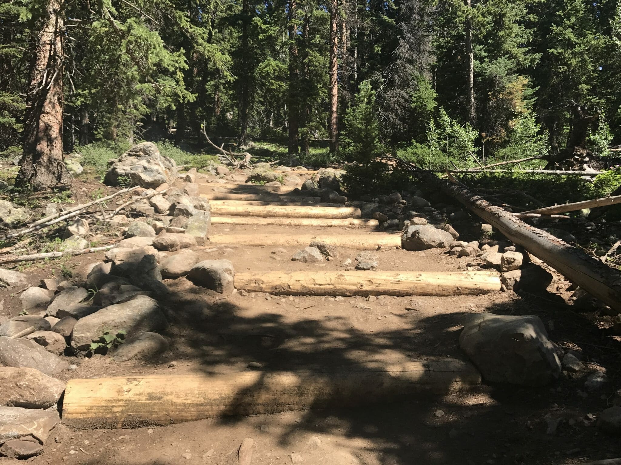
You will see a ton of these well laid out and freshly maintained logs along the trail. They help keep erosion down and help keep all the hikers going up safely along areas that can get muddy, rocky, or eroded quickly.
This stretch of the Quandary Peak Trail weaves through a verdant (an old french word for green… i couldn’t resist) forest, its paths zigzagging amidst the lively chatter of birds and the playful darting of squirrels. As I tread along, the crisp mountain air fills my lungs, mingling with the aromatic scent of pine—a true feast for the senses. Even now, as I write, I can almost feel myself transported back to those serene moments, surrounded by nature’s tranquility. This is a very humbling experience to someone from Texas who doesn’t get to experience such majestic forests.
Stay Hydrated and Take Breaks! It’s essential to stay hydrated while hiking Quandary Peak. Altitude can be demanding on your body, especially if you’re not acclimated to it. Taking frequent breaks and drinking plenty of water during the lower sections of the trail is crucial to prevent dehydration and altitude sickness later on.
Enjoy the Scenic Lower Sections!
As you hike through the early stages of the trail, you’ll traverse hard-packed dirt paths surrounded by lush forests. This part of the hike offers stunning mountain views and is perfect for families or those looking to experience the beauty of the Rockies without reaching the summit. Take your time to soak in the scenery, and you’ll have plenty of your day left to explore the surrounding area.
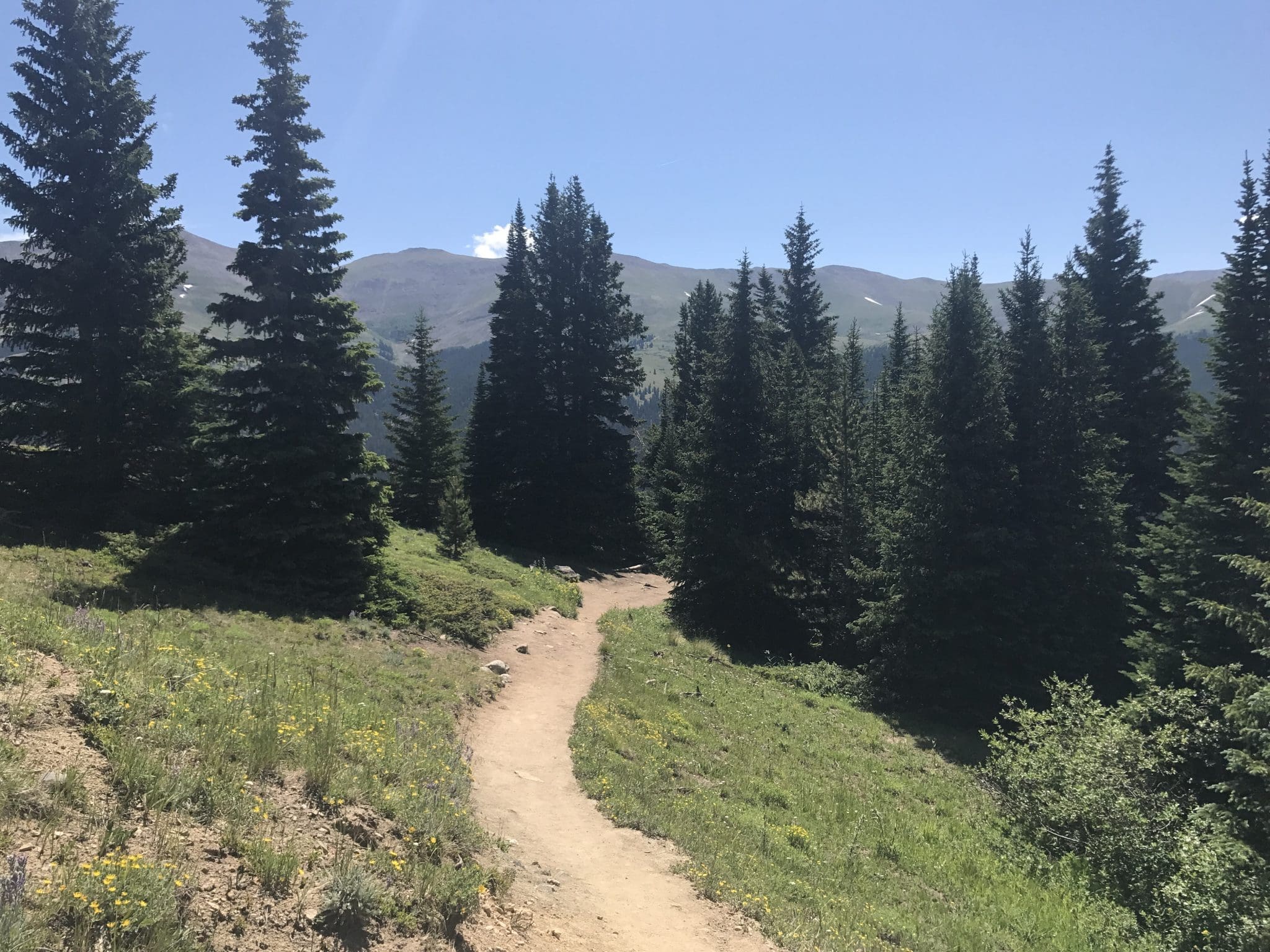
Once you have climbed about one thousand feet in altitude (and a mile of the trail), you start to break out of the thick forest and come across some exposed areas and clearings and crisscrossing above the tree line.
Take some time to soak in the views, the mountains across the way give you glimmers of being above the tree line, and the views start to open. If you haven’t applied sunscreen yet do so here before you proceed as you are wide-open now and exposed to direct sunlight with no trees.
The climb is still a good pace – mostly good brisk walk and altitude gain with some logs/steps to turn through a few areas where there is drainage. From here you will start winding your way to a small aspen grove with all the leaves happily waiving to you as you smile and trudge your way on.
As I climbed above the tree line, the steep ascent and the thinning air began to take their toll. I felt the burn in my muscles and the drain from the altitude. To cope, I took several breaks along the path to relax and recharge, allowing myself to adjust and enjoy the journey.
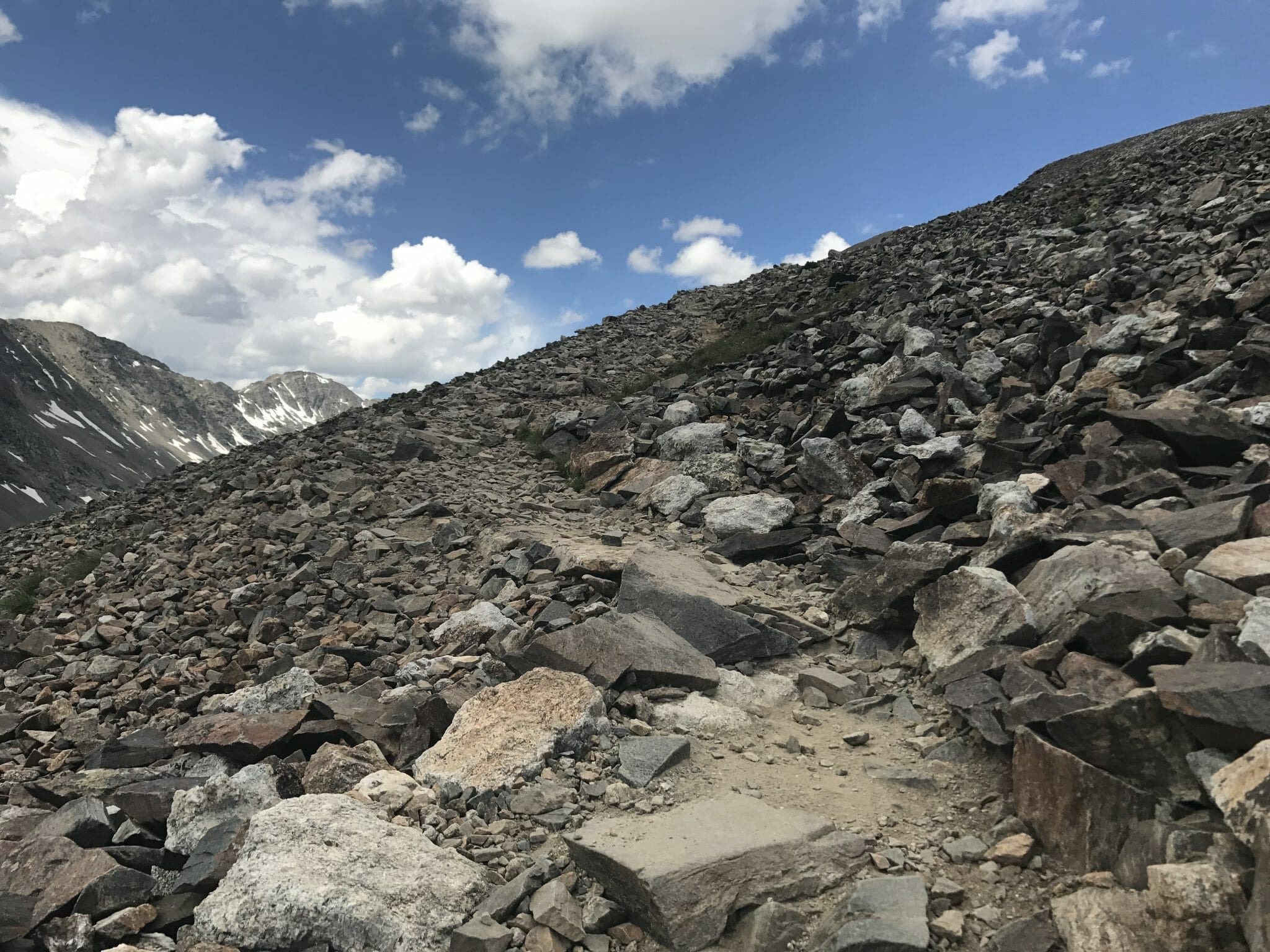
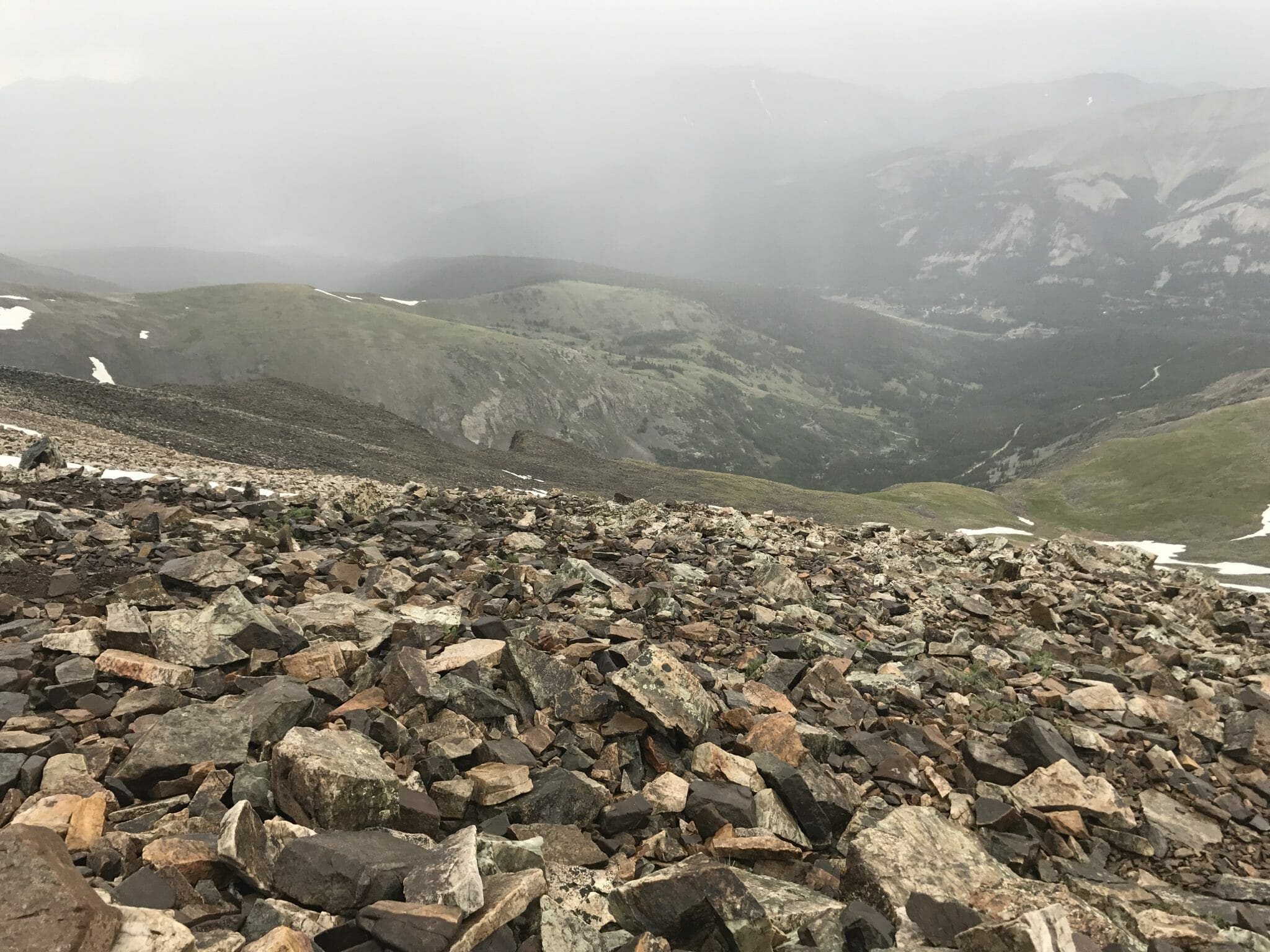
Above the tree line the mountain changes from soil/dirt trails to rock pack and manicured stone steps. At this point this is the part where I started using my trekking poles – Anything to help with stability and using my arms for additional climbing strength helped immensely.
Make sure to take lots of breaks, enjoy the views and sip water. If you haven’t taken a snack break yet, do so now I found that as I got much higher on the mountain my digestion and appetite completely changed – That delicious chocolate bar at the beginning of the trail was instant regret when I was much higher up. A banana did me well, just be sure to pack out the peel – Bananas aren’t natural up here. Take it easy, use those poles and enjoy the alpine air! Watch your footing, it’s all rocks and boulders from here on up.
So far, the weather was cooperating, and it was still blue skies and visibility for miles.
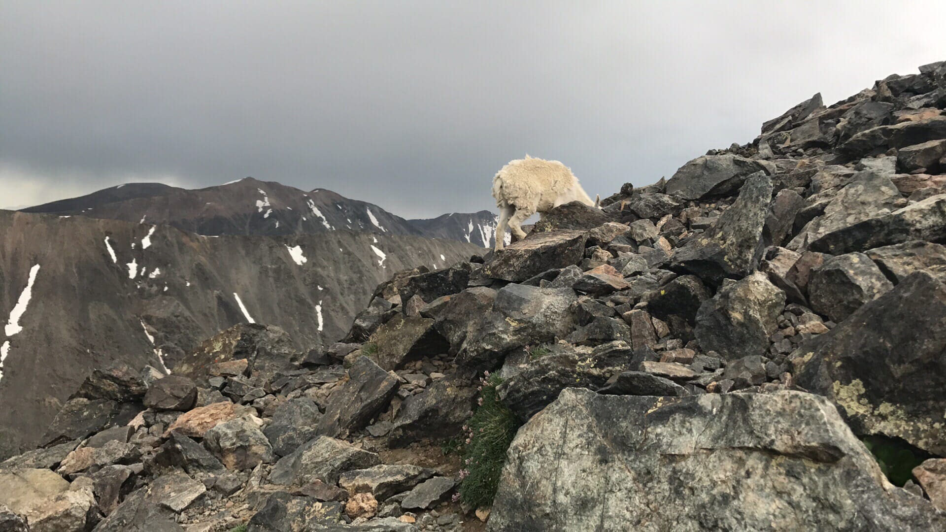
It seemed this late in the day I was the only human on the mountain, so the wild sheep were very inquisitive. It was a pleasure to meet them on my way up and to wonder how they survive and thrive so far up here!
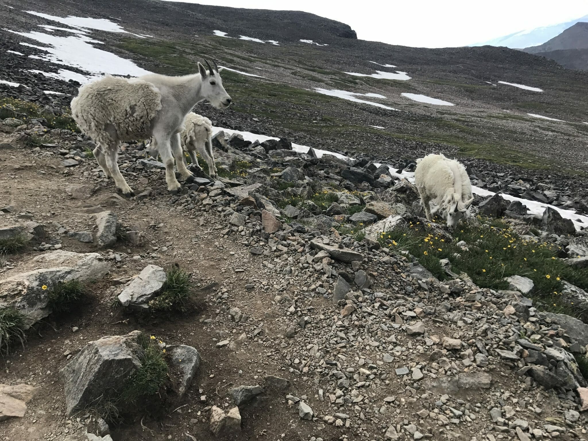
As with all wildlife, keep your distance, take some pictures, and don’t try and pet them. The sheep are cute and make funny noises, which is good because you have just now realized you’re only on a false summit and you stare up at another 1000+ foot climb above you.
Afternoon showers started settling in as I got around the 13,000-foot level. Colorado’s monsoon season is during the summer and it’s like clockwork to see storms in the mid to late afternoon. There were only a handful of people on the trail now.
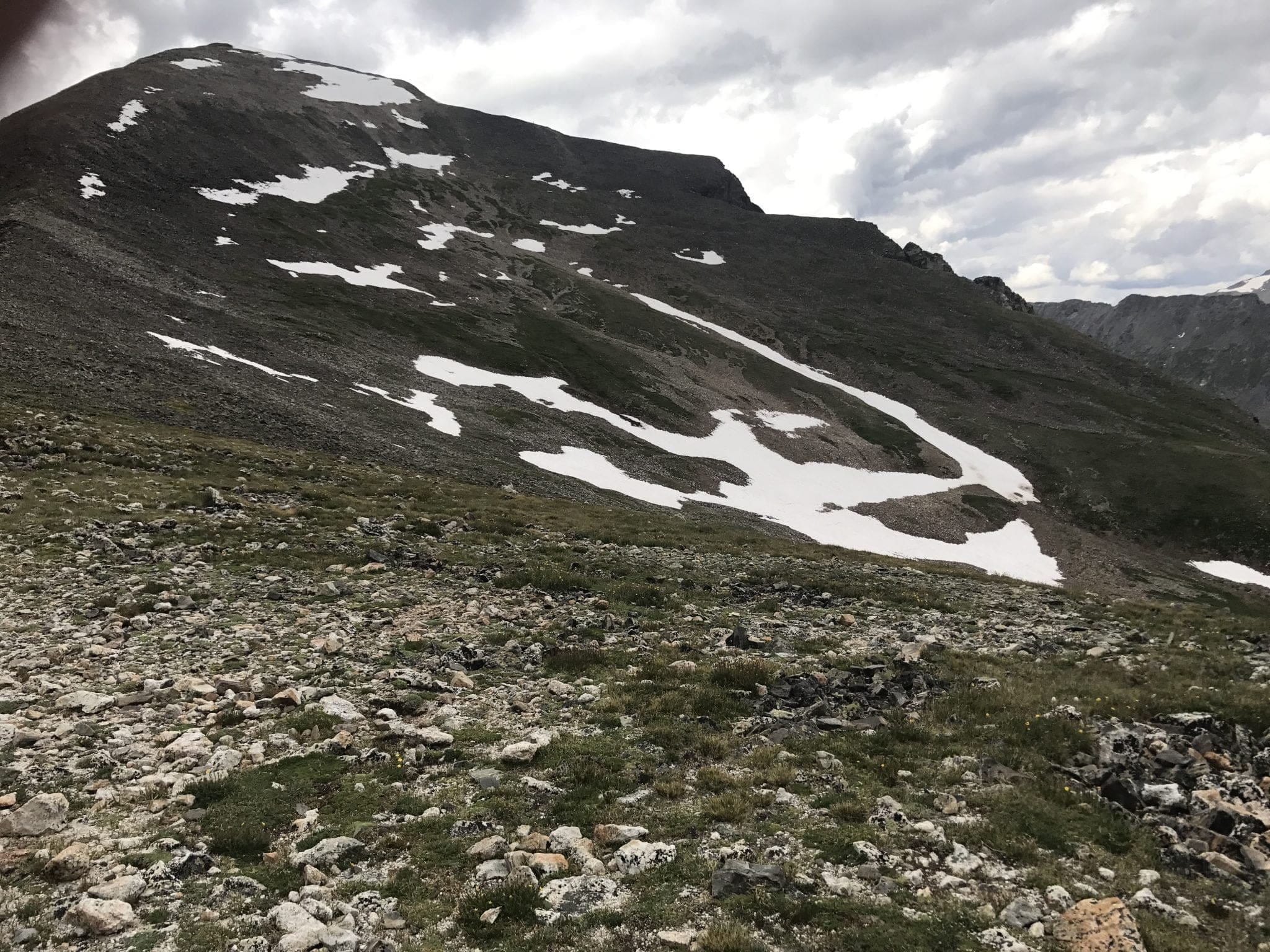
This is where the trail gets narrow, sometimes hard to find (there was a repair warning when I was up) and it’s just step by step from here. You and your knees will appreciate having hiking poles right now! I wish I had a better photo here (and that my finger wasn’t on the upper left corner), but you can see that even though you’re now at 13k feet on the false summit, that you have a LONG way to go yet. A picture just doesn’t do it justice but that ridge along the left is where you walk. The trail at this point can disappear so take your time and look for worn-out sections and look further up the mountain to see where the path recovers and follow back. The weather can be fierce up here, and it shows! Be prepared!
I must be honest; the last 1000+ feet were the hardest. I stayed in touch with my family at the cabin below because the weather was changing fast, and I could see storms in every direction around me. What started out as a beautiful clear blue sky quickly turned into rain, sleet, and storms in surrounding areas. At this point, I appreciated my investment in the right gear and preparation for the trip as well as the support of my partner helping relay weather and check on my status up here.
Quandary Mountain Summit
Reaching the summit of Mount Quandary, you’re greeted with a breathtaking panorama that stretches into infinity (usually lol). The vastness of the view is almost overwhelming (even if it is partially cloudy such as my attempt) as the world unfolds below in a stunning display of nature’s artistry. While no camera can truly do justice to the majestic scenery, the iPhone’s panorama feature valiantly attempts to capture a slice of this vast, awe-inspiring landscape
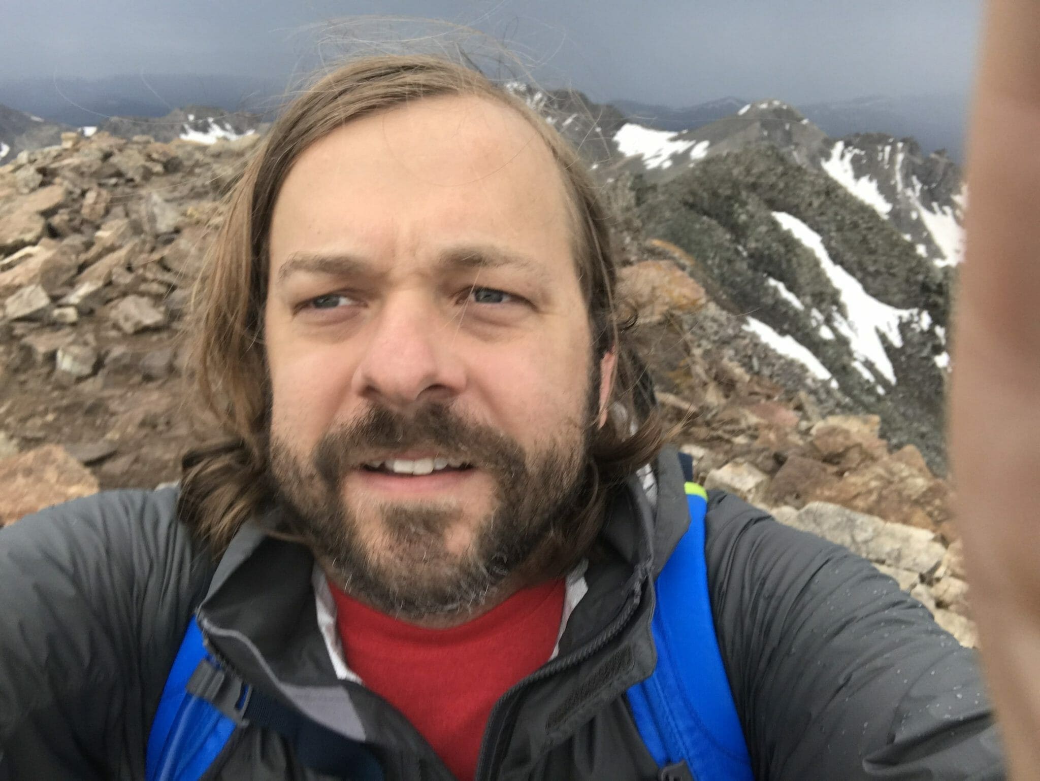
Standing atop Quandary Peak, a wave of emotions washed over me. Exhausted yet elated, I felt a profound sense of accomplishment—something I’d dreamed about since childhood. At forty-something, I marveled at my ability to summit a 14,000-foot mountain, filled with a mix of awe, excitement, and a slight thrill of fear. (Balancing for selfies at such heights can feel like a daring feat!)
From this vantage point, it felt like standing on top of the world. Surrounded by rugged peaks that have withstood the ravages of time, the endless horizon unfolded in every direction, showcasing nature’s boundless beauty. As I took in the vast landscape, the realization of the descent ahead began to sink in. The journey up had required relentless focus, one step at a time, and now the full magnitude of the adventure—the cliffs, the narrow trails—became palpably clear. It wasn’t fear I felt, but a deep recognition of my own strength and determination. This wasn’t just a physical challenge; it was an empowering, life-affirming experience.
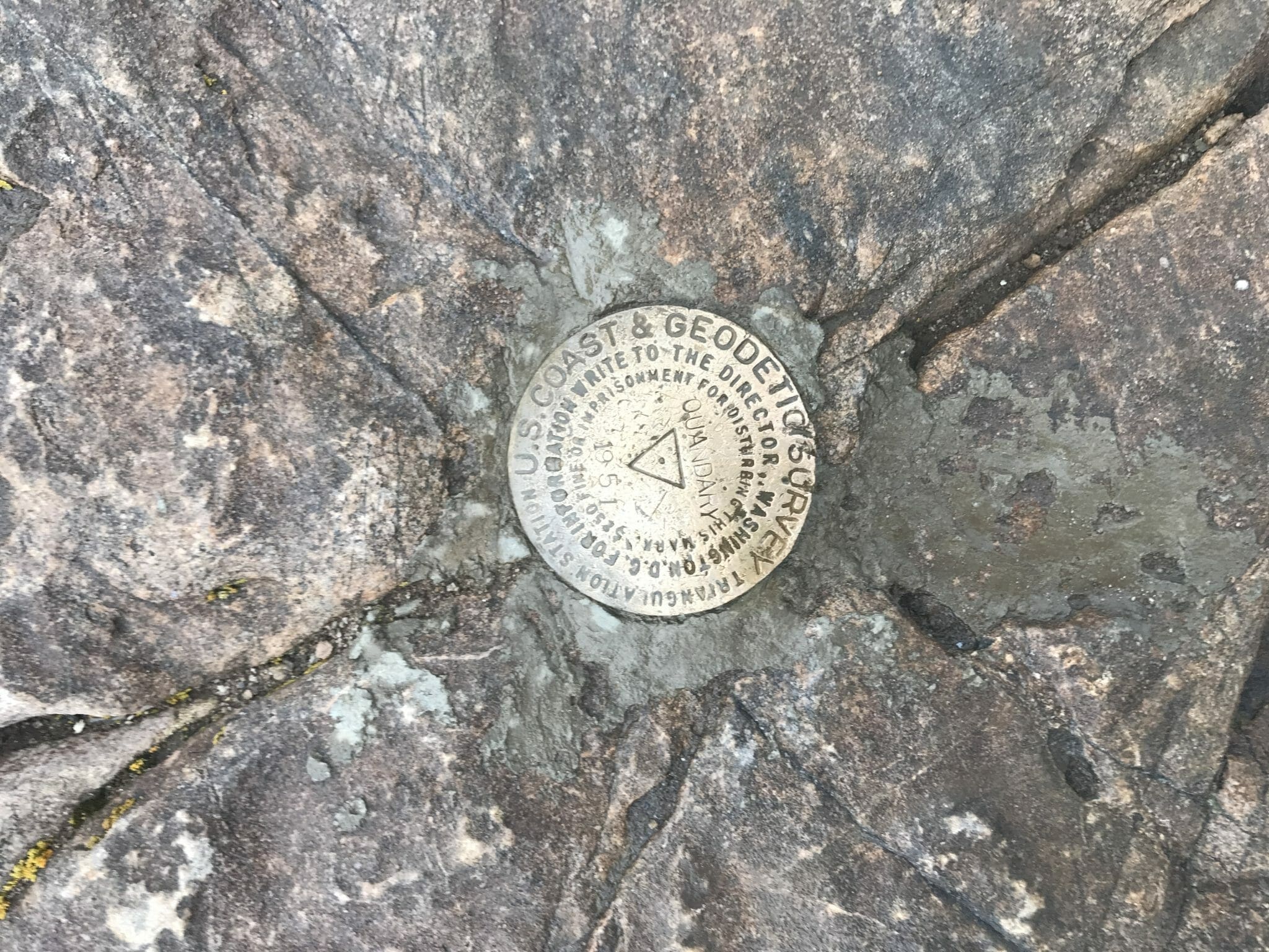
And, of course, I couldn’t leave without snapping a photo at the summit—the survey marker is a must-capture to commemorate this incredible achievement!

The panoramas from the summit were breathtaking, though my time to enjoy them was cut short as the wind, rain, and sleet intensified. With the elements closing in, I made a swift decision to descend.
I had reached the peak around 1 pm, after a challenging four-hour ascent. Starting from our HomeAway cabin added an extra mile and significant elevation to my journey, delaying my arrival. If I had started closer, I might have ascended quicker and avoided the worst of the weather.
The descent took roughly 2.5 hours. During that time, enveloped by the mountain’s vast silence, I felt a profound solitude. It was as if I was the only person in the world, alone with the mountain and my thoughts.
It was everything I needed and then some, nurturing for my soul.
Planning your Quandary Peak Hike
To maximize your chances of a successful hike, it’s essential to be well-prepared. Equip yourself with reliable clothing, gear, and ensure you have everything you might need for changing weather conditions and terrain challenges.
Acclimating
Acclimating to high altitudes is crucial, especially if Quandary Peak will be your first high-elevation hike. If you’re not already accustomed to altitudes around 10,000 feet, consider spending a few days at a similar elevation to adjust. Many hikers establish a “basecamp” around the 10k level to get their bodies acclimated. Attempting to summit Quandary Peak without proper acclimation can lead to severe altitude sickness, which includes symptoms like headaches and nausea. It’s advised not to ascend immediately after arriving from lower elevations. Altitude sickness is not something to be taken lightly!
Optimal Start time
Begin your hike early to avoid afternoon thunderstorms common during the summer monsoon season. These storms typically roll in around 1-2 PM, and you don’t want to find yourself above the treeline when they do. Aiming for a start time of 7 AM or earlier is ideal. Some hikers even start around 5 AM, using headlamps to navigate the initial lower section.
What to wear
Dress for the mountains!
Dress appropriately for variable mountain weather. Conditions on a 14,000-foot peak like Quandary can shift rapidly. A sunny, warm morning can quickly turn into a cold, windy afternoon with rain or sleet. Layering your clothing allows you to adjust to changing temperatures comfortably. Ensure you have waterproof and windproof outer layers to protect against the elements, and consider moisture-wicking materials for your base layers to keep sweat at bay
Mountain Hiking Gear
Shirt: I chose an REI fast-dry SPF shirt which was excellent for sun protection, moisture management, and comfort. The sleeves could be rolled up as needed for temperature adjustments.
Pants: My pants were REI SPF with detachable legs, which proved versatile for fluctuating temperatures and dried quickly after a rain soak. If you haven’t noticed, SPF is important – at altitude during clear skies the sun is punishing!
Shoes: I wore Keen hiking boots that provided excellent comfort, grip, and stability. I recommend adding Keen’s inserts for additional support. For those preferring lighter footwear, trail running shoes are a good alternative during the late summer months when the paths are clear of ice and slush.
Socks: I opted for “wicking” hiking socks, crucial for keeping my feet dry or drying them quickly. Remember, wet feet can lead to discomfort and blisters, which can ruin your hike.
Windbreaker/Raincoat: A Marmot rain jacket served as both my windbreaker and raincoat. Layering it with a fleece over my shirt kept me warm and dry through wind, rain, and sleet. Being able to shed or add layers quickly was essential due to rapidly changing weather conditions.
Hydration: I carried a Camel Bak, which was sufficient for most of the trip, but found I needed more water. Next time, I’ll also bring a Grayl water bottle for additional water and the option to filter water from mountain streams. I did run out of water in my Camel bak before I finished the trail.
Additional Recommendations:
- Gaiters: Useful for keeping debris and moisture out of your boots, especially if you’re hiking early in the season when you might encounter muddy conditions or snow.
- GPS Device or App: While the trail is well-marked, having a GPS can help you keep track of your progress and ensure you stay on the trail. I love using my Garmin watch since it can also track my body metrics.
- Energy Foods: Energy gels or bars can be crucial for maintaining your stamina during the long climb and descent.
Miscellaneous Gear: Always bring sunglasses, sunscreen, a comprehensive first-aid kit, a hand-held radio for emergencies, snacks for energy, a headlamp or flashlight for early starts or late finishes, a hat for sun protection, a pocketknife, and trekking poles, which are invaluable for balance and reducing strain on your knees.
With all this said, there are some folks who can run this trail and do so with just a few ounces of water. Be sure your skill, energy and fitness level is represented by the gear you bring! If you’re an ultra runner you may not need as much as someone from Texas who has no acclimation to altitude or ascents like this and will burn a lot more calories and energy muscling up the mountain. Don’t over pack – just think of what you need so you’re not miserable!
No products found.
The Trekking poles were one of my “maybe I don’t need these” purchases but in hindsight was the BEST purchase I made to make the trip possible. They just do wonders for balance, stability, and comfort going up and down the mountain.
FAQ
How difficult is Quandary Peak Trail?
The trail itself is well maintained, well traversed, and upkept by some dedicated volunteers but the difficulty is set by how well you can acclimate to altitude and how much energy you have. Quandary Mountain has several false summits on the way up that get your hopes up and let you down, so as long as you are prepared mentally and physically it’s just the effort of putting one foot in front of the other.
Are dogs allowed on Quandary Trail?
Yes. I even saw a cute dachshund that made it to the top! Please just bring baggies to pack dog poop out. It doesn’t belong on the trail or the mountain. Please be aware that there is an abundance of wildlife on the trail.
How long is the Quandary Peak Trail?
From trail head to summit and back it is 6.7 miles.
How long does it take to hike Quandary Peak?
The time it takes to complete the hike can vary widely, but most hikers should plan for approximately 4 to 6 hours to ascend and 2 to 3 hours to descend, totaling around 6 to 9 hours for the entire trip
Are there any permits or fees required to hike Quandary Peak?
There are no permits required to hike Quandary Peak as of the last update. However, parking at the trailhead is limited and can fill up early in the day during peak season. Carpooling is recommended, and always check for the latest local regulations before your hike.
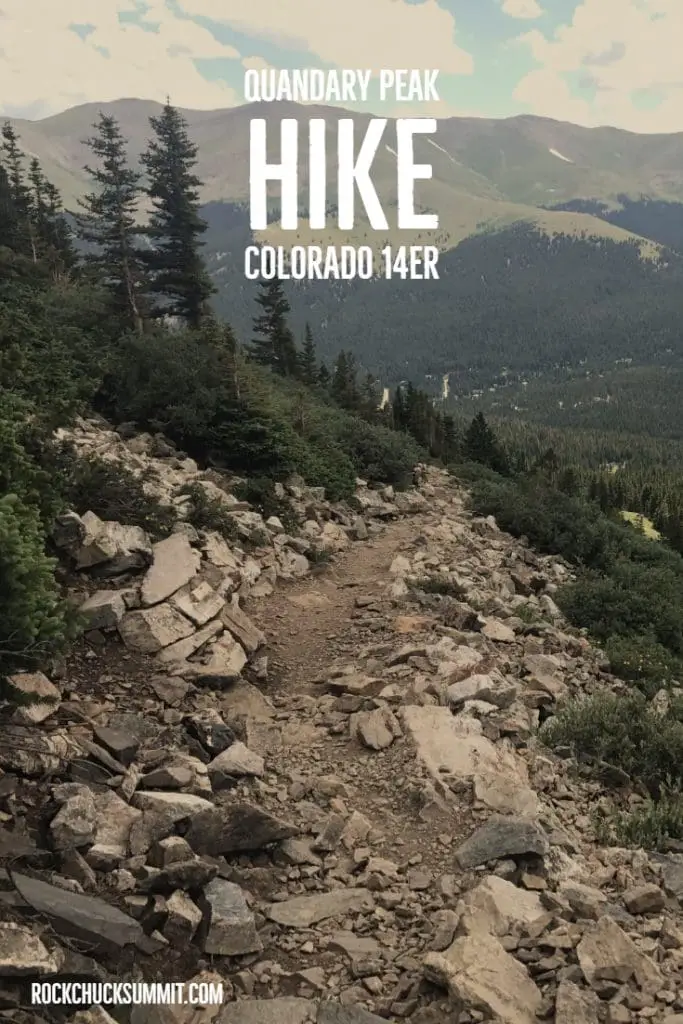
Pin it!
My journey to the summit of Quandary Peak was more rewarding than I could have ever imagined, challenging me both physically and mentally in ways that have only fueled my passion for high-altitude hiking. The allure of conquering other 14ers is irresistible, and I’m eagerly planning my next adventures, which I can’t wait to share with you. If you’ve tackled a 14er or are dreaming of your first summit, I’d love to hear your stories! Share your experiences in the comments below and let’s inspire each other to reach new heights.